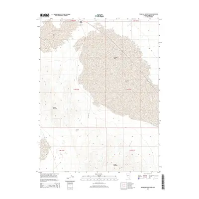
2014 Map of Bunejug Mountains
USGS Topo · Published 2014About this map
Salt Wells Basin and Eightmile Flat dominate the arid floor of this Churchill County landscape, illustrating the terminal drainage patterns of the Nevada desert. The terrain is sharply defined by the Bunejug Mountains to the west and the Cocoon Mountains to the south, with Simpson Pass providing a natural corridor between the higher elevations. This 2014 survey documents the remote infrastructure of the region, anchored by the Salt Wells Rd and the small outpost at Salt Wells. Seasonal water features like Paiute Wash and Diamond Cr trace the paths of occasional runoff across the flats, while Star Flat marks the northern extent of the basin’s transition into more mountainous territory.
Find a feature on this map
16 named features on this map. Tap any name to fly to it.
Don’t see what you’re looking for? This feature index may not catch every label — zoom into the map to look around manually.
Map Details
Editions of this 2014 Bunejug Mountains Map
This is the sole edition of this map. No revisions or reprints were ever made.
Other maps of this area

1908 · Carson Sink
USGS Topo · 1:250,000

1910 · Carson Sink
USGS Topo · 1:250,000

1951 · Carson Lake
USGS Topo · 1:62,500

1951 · Allen Springs
USGS Topo · 1:62,500

1957 · Reno
USGS Topo · 1:250,000

1959 · Reno
USGS Topo · 1:250,000

1960 · Reno
USGS Topo · 1:250,000

1972 · Fourmile Flat
USGS Topo · 1:24,000

1972 · Diamond Canyon
USGS Topo · 1:24,000

1979 · Fallon
USGS Topo · 1:100,000