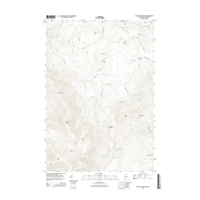
2015 Map of Bunnell Mountain
USGS Topo · Published 2015About this map
Bungy occupies a small valley clearing at the heart of this mountain landscape, where the E Br Simms Stream and other tributaries begin their descent through the high peaks of Coos County. The terrain is defined by a series of prominent summits, including Bunnell Mountain, Gore Mtn, and Whitcomb Mtn, which frame the deep passages of Cleveland Notch and Moran Notch. The drainage patterns here are intricate, with Nash Stream and the Mohawk River drawing water from the high ridges and plateaus. These watercourses were historically vital to local navigation and early industries like logging. Significant high-elevation features such as Cranberry Bog Pond and Lime Pond sit among these peaks, illustrating the unique alpine wetlands found throughout this part of the White Mountains. A network of rural routes like Marshall Hill Rd and Old Mill Rd provide access to these remote reaches, tracing the older paths established by early settlers and loggers.
Find a feature on this map
69 named features on this map. Tap any name to fly to it.
Don’t see what you’re looking for? This feature index may not catch every label — zoom into the map to look around manually.
Map Details
Editions of this 2015 Bunnell Mountain Map
This is the sole edition of this map. No revisions or reprints were ever made.
Other maps of this area

1920 · Guildhall
USGS Topo · 1:62,500

1929 · Averill
USGS Topo · 1:62,500

1930 · Percy
USGS Topo · 1:62,500

1930 · Dixville
USGS Topo · 1:62,500

1931 · Guildhall
USGS Topo · 1:48,000

1933 · Guildhall
USGS Topo · 1:48,000

1933 · Dixville
USGS Topo · 1:62,500

1934 · Percy
USGS Topo · 1:62,500

1934 · Dixville
USGS Topo · 1:62,500

1937 · Guildhall
USGS Topo · 1:62,500