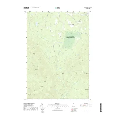
2018 Map of Bunnell Mountain
USGS Topo · Published 2018About this map
The Silvio O Conte National Fish and Wildlife Refuge occupies a central portion of this landscape, emphasizing the preservation of the Connecticut River watershed's headwaters. The topography is defined by a series of prominent peaks and high-elevation notches, including Bunnell Mtn, Gore Mtn, and Castle Mtn. The drainage patterns here are complex, with the Mohawk River flowing in the northeast while numerous branches of Simms Stream and Nash Stream carve through the deep valleys.
Find a feature on this map
65 named features on this map. Tap any name to fly to it.
Don’t see what you’re looking for? This feature index may not catch every label — zoom into the map to look around manually.
Map Details
Editions of this 2018 Bunnell Mountain Map
This is the sole edition of this map. No revisions or reprints were ever made.
Other maps of this area

1920 · Guildhall
USGS Topo · 1:62,500

1929 · Averill
USGS Topo · 1:62,500

1930 · Percy
USGS Topo · 1:62,500

1930 · Dixville
USGS Topo · 1:62,500

1931 · Guildhall
USGS Topo · 1:48,000

1933 · Guildhall
USGS Topo · 1:48,000

1933 · Dixville
USGS Topo · 1:62,500

1934 · Percy
USGS Topo · 1:62,500

1934 · Dixville
USGS Topo · 1:62,500

1937 · Guildhall
USGS Topo · 1:62,500