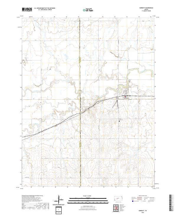
2022 Map of Burdett
USGS Topo · Published 2022About this map
The small town of Burdett sits at the intersection of local routes in western Pawnee County, where the landscape is defined by the winding course of the Pawnee River. This map shows the settlement's street grid, including names like Broadway Ave and Spruce St, situated just north of the Rucker Burdett Airport. To the south of the town, the Browns Grove Cem remains a significant landmark for those tracing local family history. The surrounding countryside is dissected by several waterways, including the meandering Buckner Cr and Dry Cr, which carve through the agricultural sections. A network of rural section roads, such as Cow Path Rd and Garfield Rd, illustrates the persistent grid system that governs this part of the Kansas plains. The boundary between Hodgeman Co and Pawnee Co bisects the western half of the sheet, marking a clear administrative division in the open terrain.
Find a feature on this map
36 named features on this map. Tap any name to fly to it.
Don’t see what you’re looking for? This feature index may not catch every label — zoom into the map to look around manually.
Map Details
Editions of this 2022 Burdett Map
This is the sole edition of this map. No revisions or reprints were ever made.
Other maps of this area

1889 · Larned
USGS Topo · 1:125,000

1891 · Larned
USGS Topo · 1:125,000

1892 · Ness
USGS Topo · 1:125,000

1894 · Ness
USGS Topo · 1:125,000

1955 · Great Bend
USGS Topo · 1:250,000

1957 · Great Bend
USGS Topo · 1:250,000

1958 · Great Bend
USGS Topo · 1:250,000
1970 · Hanston
USGS Topo · 1:24,000

1970 · Hanston NW
USGS Topo · 1:24,000
1970 · Rozel
USGS Topo · 1:24,000