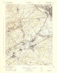
1942 Map of Burlington
USGS Topo · Published 1942About this map
The Delaware River serves as the central artery for this 1942 industrial and transportation study, dividing the landscape between Bucks County, Pennsylvania, and Burlington County, New Jersey. The riverfront is heavily developed with maritime and rail infrastructure, featuring Tullytown Wharf, Andalusia Wharf, and the historical crossing at Dunks Ferry. To the north, the Delaware & Raritan Canal Feeder runs parallel to the water near the State Lunatic Asylum in Trenton.
Find a feature on this map
132 named features on this map. Tap any name to fly to it.
Don’t see what you’re looking for? This feature index may not catch every label — zoom into the map to look around manually.
Map Details
Editions of this 1942 Burlington Map
This is the sole edition of this map. No revisions or reprints were ever made.
Other maps of this area

1888 · Bordentown
USGS Topo · 1:62,500

1888 · Pemberton
USGS Topo · 1:62,500

1888 · Mount Holly
USGS Topo · 1:62,500

1888 · Princeton
USGS Topo · 1:62,500

1890 · Lambertville
USGS Topo · 1:62,500

1890 · Doylestown
USGS Topo · 1:62,500

1890 · Burlington
USGS Topo · 1:62,500

1891 · Lambertville
USGS Topo · 1:62,500

1891 · Doylestown
USGS Topo · 1:62,500

1891 · Philadelphia
USGS Topo · 1:62,500