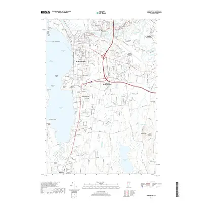
2018 Map of Burlington
USGS Topo · Published 2018About this map
Lake Champlain dominates the western edge of this 2018 survey, where the urban landscape of Burlington meets the waterfront at Burlington Bay. The map documents a dense network of civic and religious history, particularly through its extensive cemetery records such as the Hebrew Holy Society Cem, Lakeview Cem, and Elmwood Avenue Cem. To the north, the Winooski River carves through the Winooski Gorge, separating the city from Winooski and Essex Junction. Educational centers like the Univ of Vermont and Saint Michaels College anchor the interior, while the southern reach transitions into the more open spaces of South Burlington and Shelburne, featuring Shelburne Pond and the Museum Covered Bridge. This modern topographic study captures the contemporary footprint of Vermont's primary population center alongside long-standing landmarks like Fort Ethan Allen Cem.
Find a feature on this map
61 named features on this map. Tap any name to fly to it.
Don’t see what you’re looking for? This feature index may not catch every label — zoom into the map to look around manually.
Map Details
Editions of this 2018 Burlington Map
This is the sole edition of this map. No revisions or reprints were ever made.
Other maps of this area

1894 · Plattsburg
USGS Topo · 1:62,500

1895 · Willsboro
USGS Topo · 1:62,500

1906 · Plattsburg
USGS Topo · 1:62,500

1906 · Burlington
USGS Topo · 1:62,500

1913 · Milton
USGS Topo · 1:48,000

1915 · Milton
USGS Topo · 1:62,500

1919 · Burlington
USGS Topo · 1:62,500

1939 · Plattsburg
USGS Topo · 1:62,500

1941 · Plattsburg
USGS Topo · 1:62,500

1941 · Willsboro
USGS Topo · 1:62,500