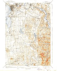
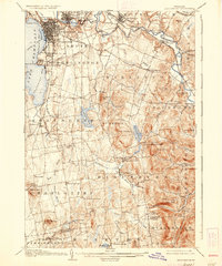
1906 Map of Burlington
USGS Topo · Published 1943About this map
Burlington sits at the heart of this early twentieth-century survey, revealing the city’s established grid and its connections to the surrounding Chittenden County landscape. The University of Vermont dominates the eastern rise of the city, while the industrial and transit importance of the waterfront is evident at the Shipyard and the complex rail intersections of the Rutland R R and Central Vermont R R. Beyond the urban core, the map captures the transition to a rural agrarian economy defined by hamlets such as Rhode Island Corners, Prindle Corners, and Mechanicsville.
Find a feature on this map
79 named features on this map. Tap any name to fly to it.
Don’t see what you’re looking for? This feature index may not catch every label — zoom into the map to look around manually.
Map Details
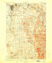
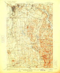
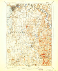
Editions of this 1906 Burlington Map
7 editions found
Other maps of this area

1894 · Port Henry
USGS Topo · 1:62,500

1894 · Plattsburg
USGS Topo · 1:62,500

1895 · Willsboro
USGS Topo · 1:62,500

1898 · Port Henry
USGS Topo · 1:62,500

1903 · Middlebury
USGS Topo · 1:62,500

1905 · Middlebury
USGS Topo · 1:62,500

1906 · Plattsburg
USGS Topo · 1:62,500

1906 · Burlington
USGS Topo · 1:62,500

1913 · Milton
USGS Topo · 1:48,000

1915 · Milton
USGS Topo · 1:62,500