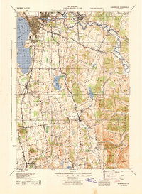
1944 Map of Burlington
USGS Topo · Published 1944About this map
Burlington serves as the bustling anchor of this mid-century Vermont landscape, with the sprawling campus of the University of Vermont and the Burlington Airport signaling its growth as a regional hub. Along the waterfront of Lake Champlain, the Shipyard and Redrocks Park define the city's edge, while the industrial heritage of the area is visible at the Limekiln works near Winooski. A network of rail lines, including the Central Vermont and Rutland railroads, connects the lakefront to inland settlements like Essex Junction and Richmond. Moving south, the terrain becomes more varied with clusters of homes at Shelburne Falls and small crossroads like Rhode Island Corners. The map provides a detailed view of these rural communities and the family-named landmarks like Mt Philo and Brownell Mt that have long defined the Chittenden County countryside.
Find a feature on this map
81 named features on this map. Tap any name to fly to it.
Don’t see what you’re looking for? This feature index may not catch every label — zoom into the map to look around manually.
Map Details
Editions of this 1944 Burlington Map
2 editions found
Other maps of this area

1894 · Port Henry
USGS Topo · 1:62,500

1894 · Plattsburg
USGS Topo · 1:62,500

1895 · Willsboro
USGS Topo · 1:62,500

1898 · Port Henry
USGS Topo · 1:62,500

1903 · Middlebury
USGS Topo · 1:62,500

1905 · Middlebury
USGS Topo · 1:62,500

1906 · Plattsburg
USGS Topo · 1:62,500

1906 · Burlington
USGS Topo · 1:62,500

1913 · Milton
USGS Topo · 1:48,000

1915 · Milton
USGS Topo · 1:62,500