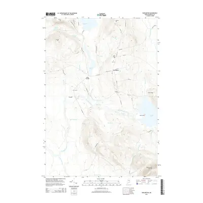
2014 Map of Burlington
USGS Topo · Published 2014About this map
The Passadumkeag River flows through a landscape defined by glacial topography and timberland in this 2014 study of Penobscot County. The settlements of Burlington and Lowell are central hubs in a network of roads that follow the high ground, such as Main Rd and Church Hill Rd. Local history is anchored by the Lowell Cem and Page Cem, while the industrial past is hinted at by the naming of Gristmill Pond on Eskutassis Stream. To the south and east, the terrain rises toward Passadumkeag Mountain, overlooking a complex of water bodies including Saponac Pond and Eskutassis Pond. The presence of features like White Horse Rips and The Narrows indicates the varied character of the river, which has long been a focal point for the region's geography and navigation.
Find a feature on this map
58 named features on this map. Tap any name to fly to it.
Don’t see what you’re looking for? This feature index may not catch every label — zoom into the map to look around manually.
Map Details
Editions of this 2014 Burlington Map
This is the sole edition of this map. No revisions or reprints were ever made.
Other maps of this area

1917 · Passadumkeag
USGS Topo · 1:62,500

1920 · Winn
USGS Topo · 1:62,500

1931 · Saponac
USGS Topo · 1:48,000

1934 · Saponac
USGS Topo · 1:62,500

1942 · Lincoln
USGS Topo · 1:62,500

1954 · Millinocket
USGS Topo · 1:250,000

1957 · Lincoln
USGS Topo · 1:62,500

1957 · Saponac
USGS Topo · 1:62,500

1958 · Millinocket
USGS Topo · 1:250,000

1960 · Millinocket
USGS Topo · 1:250,000