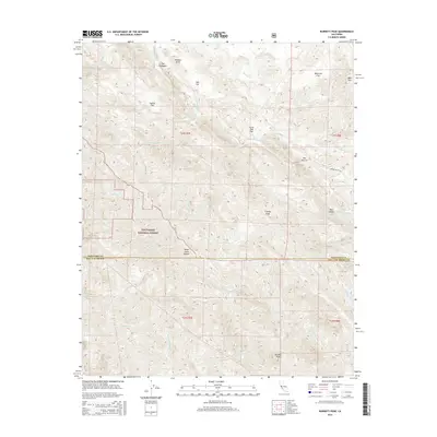
2015 Map of Burnett Peak
USGS Topo · Published 2015About this map
The Santa Lucia Range dominates this portion of the Central Coast, where the boundary between Monterey Co and San Luis Obispo Co cuts across the southern terrain. This section of the Los Padres National Forest is defined by a network of steep drainages, including Salmon Cr, Chris Flood Cr, and Burnett Cr, which flow through the mountains toward the Nacimiento River. Significant topographical markers like The Palisades and Piedras Altas rise above the high flats, suggesting a landscape of notable relief and geological variation.
Find a feature on this map
37 named features on this map. Tap any name to fly to it.
Don’t see what you’re looking for? This feature index may not catch every label — zoom into the map to look around manually.
Map Details
Editions of this 2015 Burnett Peak Map
This is the sole edition of this map. No revisions or reprints were ever made.
Other maps of this area

1919 · Bryson
USGS Topo · 1:62,500

1919 · Piedras Blancas
USGS Topo · 1:62,500

1919 · San Simeon
USGS Topo · 1:62,500

1921 · Cape San Martin
USGS Topo · 1:62,500

1927 · Piedras Blancas
USGS Topo · 1:62,500

1937 · San Simeon
USGS Topo · 1:62,500

1941 · Cape San Martin
USGS Topo · 1:62,500

1941 · Bryson
USGS Topo · 1:62,500

1942 · Bryson
USGS Topo · 1:62,500

1942 · Cape San Martin
USGS Topo · 1:62,500