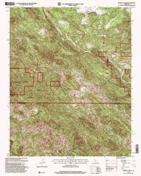
1995 Map of Burnett Peak
USGS Topo · Published 2000About this map
The Santa Lucia Range dominates this landscape along the border of Monterey and San Luis Obispo counties, where the high peaks and steep canyons of the Los Padres National Forest meet the historic boundaries of the El Piojo Grant and Piedra Blanca Grant. This 1995 revision documents a wilderness-heavy region defined by the Nacimiento River, which snakes through the northern half of the quadrangle before passing through a narrow constriction known as The Shut-In.
Find a feature on this map
17 named features on this map. Tap any name to fly to it.
Don’t see what you’re looking for? This feature index may not catch every label — zoom into the map to look around manually.
Map Details
Editions of this 1995 Burnett Peak Map
This is the sole edition of this map. No revisions or reprints were ever made.
Other maps of this area

1919 · Bryson
USGS Topo · 1:62,500

1919 · Piedras Blancas
USGS Topo · 1:62,500

1919 · San Simeon
USGS Topo · 1:62,500

1921 · Cape San Martin
USGS Topo · 1:62,500

1927 · Piedras Blancas
USGS Topo · 1:62,500

1937 · San Simeon
USGS Topo · 1:62,500

1941 · Cape San Martin
USGS Topo · 1:62,500

1941 · Bryson
USGS Topo · 1:62,500

1942 · Bryson
USGS Topo · 1:62,500

1942 · Cape San Martin
USGS Topo · 1:62,500