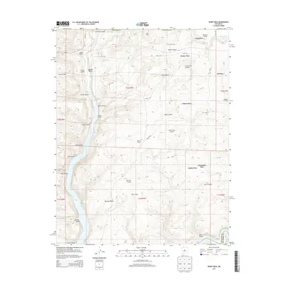
2013 Map of Burnt Mesa
USGS Topo · Published 2013About this map
Navajo Reservoir and the Los Pinos River dominate this New Mexico landscape, where the terrain is deeply incised by a series of dramatic canyons including Cemetery Canyon, Mentzel Canyon, and Ulibarri Canyon. The map records a series of named homesteads or family localities, such as Garcia Place, Lucero Place, and Christopher Place, which are scattered across the high ground between the drainage systems. This distribution suggests a history of dryland ranching and isolated rural settlement patterns characteristic of San Juan County. Human alteration of the water system is evident through features like the Mentzel Ditch, which follows the contours of the higher elevations. These distinctively named 'places' provide excellent geographic markers for family researchers tracking residents in this corner of the state, while landmarks like Hole in Rock and Burnt Mesa define the local topography.
Find a feature on this map
86 named features on this map. Tap any name to fly to it.
Don’t see what you’re looking for? This feature index may not catch every label — zoom into the map to look around manually.
Map Details
Editions of this 2013 Burnt Mesa Map
This is the sole edition of this map. No revisions or reprints were ever made.
Other maps of this area

1889 · Largo
USGS Topo · 1:250,000

1895 · Largo
USGS Topo · 1:250,000

1908 · Ignacio
USGS Topo · 1:125,000

1924 · Ignacio
USGS Topo · 1:125,000

1924 · Pagosa Springs
USGS Topo · 1:125,000

1927 · Pagosa Springs
USGS Topo · 1:125,000

1945 · Durango
USGS Topo · 1:250,000

1953 · Durango
USGS Topo · 1:250,000

1954 · Durango
USGS Topo · 1:250,000

1954 · Allison
USGS Topo · 1:24,000