1954 Map of Allison
USGS Topo · Published 1955About this map
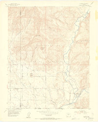
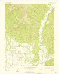
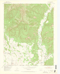
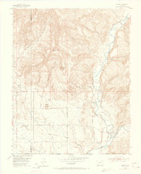
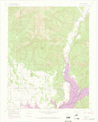
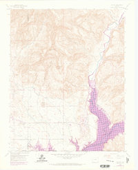
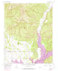
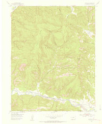
The Southern Ute Indian Reservation dominates the landscape of this 1954 survey, showcasing a complex network of mid-century irrigation and rail transport. The Denver and Rio Grande Western railroad tracks cut through the southern portion of the quadrangle, serving the small settlements of Allison and Arboles. This era highlights the vital role of water management in the high desert, evidenced by the Pine River Canal, North Lateral, and numerous flumes and ditches that diverted water from the Piedra River.
Find a feature on this map
30 named features on this map. Tap any name to fly to it.
Don’t see what you’re looking for? This feature index may not catch every label — zoom into the map to look around manually.
Map Details
Editions of this 1954 Allison Map
7 editions found
Other maps of this area

1889 · Largo
USGS Topo · 1:250,000

1895 · Largo
USGS Topo · 1:250,000

1908 · Ignacio
USGS Topo · 1:125,000

1924 · Ignacio
USGS Topo · 1:125,000

1924 · Pagosa Springs
USGS Topo · 1:125,000

1927 · Pagosa Springs
USGS Topo · 1:125,000

1945 · Durango
USGS Topo · 1:250,000

1953 · Durango
USGS Topo · 1:250,000

1954 · Durango
USGS Topo · 1:250,000
1954 · Carracas
USGS Topo · 1:24,000