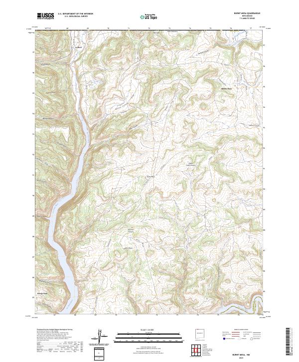
2023 Map of Burnt Mesa
USGS Topo · Published 2023About this map
The Los Pinos River carves a deep north-south path through this San Juan County landscape, meeting the San Juan River at the southern edge of the sheet. Near this confluence, the settlement of Navajo Dam serves as a modern waypoint, while the northern reaches include the community of La Boca near the Colorado border. The terrain is defined by elevated plateaus like Mid Mesa and Middle Mesa, which are dissected by a dense network of drainages including Garcia Canyon and Cottonwood Canyon.
Find a feature on this map
46 named features on this map. Tap any name to fly to it.
Don’t see what you’re looking for? This feature index may not catch every label — zoom into the map to look around manually.
Map Details
Editions of this 2023 Burnt Mesa Map
This is the sole edition of this map. No revisions or reprints were ever made.
Other maps of this area

1889 · Largo
USGS Topo · 1:250,000

1895 · Largo
USGS Topo · 1:250,000

1908 · Ignacio
USGS Topo · 1:125,000

1924 · Ignacio
USGS Topo · 1:125,000

1924 · Pagosa Springs
USGS Topo · 1:125,000

1927 · Pagosa Springs
USGS Topo · 1:125,000

1945 · Durango
USGS Topo · 1:250,000

1953 · Durango
USGS Topo · 1:250,000

1954 · Durango
USGS Topo · 1:250,000

1954 · Allison
USGS Topo · 1:24,000