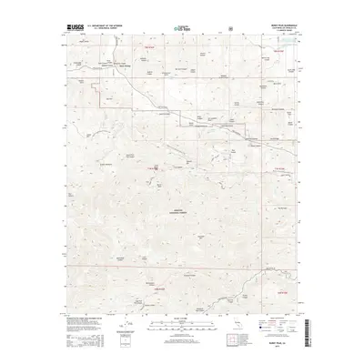
2015 Map of Burnt Peak
USGS Topo · Published 2015About this map
The San Andreas Fault cuts directly across this portion of the Transverse Ranges, shaping a landscape of deep canyons and prominent ridges. Within the Angeles National Forest, the terrain is defined by a series of north-south drainages such as Kings Canyon and Sawmill Canyon, which feed into the Elizabeth Lake Canyon system. Evidence of human engineering in this complex geology is visible in the Los Angeles Aqueduct and the Kings Canyon Percolation Basin at the northeastern corner of the map. High-elevation settlements and landmarks like Three Points and Bushnell Summit serve as local hubs along Pine Canyon Rd, while the Pacific Crest National Scenic Trail winds through the southern ridges near Liebre Mtn. This survey captures the intersection of critical infrastructure and recreational wilderness in the early twenty-first century.
Find a feature on this map
69 named features on this map. Tap any name to fly to it.
Don’t see what you’re looking for? This feature index may not catch every label — zoom into the map to look around manually.
Map Details
Editions of this 2015 Burnt Peak Map
This is the sole edition of this map. No revisions or reprints were ever made.
Other maps of this area

1903 · Tejon
USGS Topo · 1:125,000

1915 · Elizabeth Lake
USGS Topo · 1:125,000

1917 · Elizabeth Lake
USGS Topo · 1:125,000

1931 · Warm Spring
USGS Topo · 1:24,000

1931 · Redrock Mtn
USGS Topo · 1:24,000

1932 · Hughes Lake
USGS Topo · 1:24,000

1932 · Fairmont
USGS Topo · 1:24,000

1932 · Neenach
USGS Topo · 1:24,000

1933 · Manzana
USGS Topo · 1:24,000
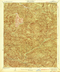
1936 · Warm Spring
USGS Topo · 1:24,000