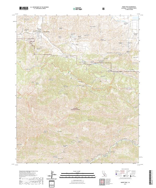
2021 Map of Burnt Peak
USGS Topo · Published 2021About this map
Angeles National Forest dominates this section of the Sierra Pelona Mountains, where the high-altitude landscape is deeply incised by complex canyon systems. The tiny mountain settlement of Three Points serves as a local landmark near the northern edge of the forest, while the modern engineering of the Los Angeles Aqueduct cuts through the northern flats. This area represents a critical intersection of natural geologic forces and human infrastructure, most notably where the San Andreas Fault runs through the center of the sheet near Hidden Lake and Tweedy Lake. The geography is defined by prominent ridgelines including Portal Ridge and Bushnell Summit, which are traversed by the Pacific Crest National Scenic Trail. Named canyons such as Deadhorse Canyon and Spencer Canyon illustrate the rugged drainage patterns that characterize this segment of the Transverse Ranges, south of Happy Valley.
Find a feature on this map
67 named features on this map. Tap any name to fly to it.
Don’t see what you’re looking for? This feature index may not catch every label — zoom into the map to look around manually.
Map Details
Editions of this 2021 Burnt Peak Map
This is the sole edition of this map. No revisions or reprints were ever made.
Other maps of this area

1903 · Tejon
USGS Topo · 1:125,000

1915 · Elizabeth Lake
USGS Topo · 1:125,000

1917 · Elizabeth Lake
USGS Topo · 1:125,000

1931 · Warm Spring
USGS Topo · 1:24,000

1931 · Redrock Mtn
USGS Topo · 1:24,000

1932 · Hughes Lake
USGS Topo · 1:24,000

1932 · Fairmont
USGS Topo · 1:24,000

1932 · Neenach
USGS Topo · 1:24,000

1933 · Manzana
USGS Topo · 1:24,000
1936 · Warm Spring
USGS Topo · 1:24,000