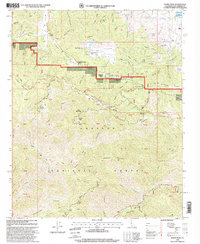
1995 Map of Burnt Peak
USGS Topo · Published 1999About this map
The San Andreas Rift Zone bisects this portion of the northern Angeles National Forest, marking a distinct geological and topographic transition through the Sierra Pelona Mountains. High-elevation settlements such as Three Points and Deer Lodge are shown alongside seasonal recreation sites like the Timberline Meadows Resort and the Tweedy Lake Club. The landscape is dominated by the steep slopes of Burnt Peak and Sawmill Mountain, where historic mining operations including the Big Chief Mine and Maxwell Mine were once active. Sections of the Pacific Crest National Scenic Trail wind across Liebre Mountain, following the ridges above deep drainages like Fish Canyon and Rattlesnake Canyon. To the south, the terrain descends toward Elizabeth Lake and the Rift Zone fault line, where family-named landmarks like Kings Ranch and Hidden Lake Ranch denote the area's transition into ranching and resort communities during the late 20th century.
Find a feature on this map
93 named features on this map. Tap any name to fly to it.
Don’t see what you’re looking for? This feature index may not catch every label — zoom into the map to look around manually.
Map Details
Editions of this 1995 Burnt Peak Map
This is the sole edition of this map. No revisions or reprints were ever made.
Other maps of this area

1903 · Tejon
USGS Topo · 1:125,000

1915 · Elizabeth Lake
USGS Topo · 1:125,000

1917 · Elizabeth Lake
USGS Topo · 1:125,000

1931 · Warm Spring
USGS Topo · 1:24,000

1931 · Redrock Mtn
USGS Topo · 1:24,000

1932 · Hughes Lake
USGS Topo · 1:24,000

1932 · Fairmont
USGS Topo · 1:24,000

1932 · Neenach
USGS Topo · 1:24,000

1933 · Manzana
USGS Topo · 1:24,000
1936 · Warm Spring
USGS Topo · 1:24,000