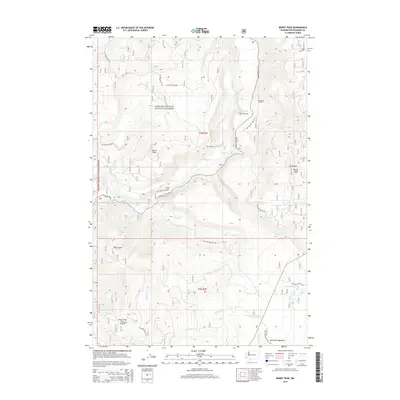
2014 Map of Burnt Peak
USGS Topo · Published 2014About this map
Gifford Pinchot National Forest defines this high-elevation landscape, where the Lewis River and Wind River drainages meet among prominent summits like Burnt Peak and the Crazy Hills. The 2014 survey reveals an intricate network of forestry access roads, including Nat For Dev Rd 90, which connect remote recreational sites and landmarks. Of particular interest to those studying the area's natural features are the documented water drops at Big Creek Falls and Curly Creek Falls, as well as the unusually named Two Times Four Prairie to the southwest. Cultural artifacts of the forest's management and recreational history appear in the form of wilderness outposts like Kum Back Shelter and Bolt Shelter, while the southern portion of the quadrangle includes the protected expanse of McClellan Meadows.
Find a feature on this map
36 named features on this map. Tap any name to fly to it.
Don’t see what you’re looking for? This feature index may not catch every label — zoom into the map to look around manually.
Map Details
Editions of this 2014 Burnt Peak Map
This is the sole edition of this map. No revisions or reprints were ever made.
Other maps of this area

1919 · Mount St Helens
USGS Topo · 1:125,000

1926 · Steamboat Mtn
USGS Topo · 1:125,000

1926 · Hood River
USGS Topo · 1:125,000

1929 · Hood River
USGS Topo · 1:125,000

1931 · Steamboat Mtn
USGS Topo · 1:125,000

1940 · Lookout Mtn
USGS Topo · 1:62,500

1948 · Vancouver
USGS Topo · 1:250,000

1950 · Vancouver
USGS Topo · 1:250,000

1950 · Vancouver
USGS Topo · 1:250,000

1950 · Yakima
USGS Topo · 1:250,000