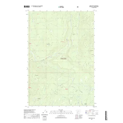
2020 Map of Burnt Peak
USGS Topo · Published 2020About this map
The Gifford Pinchot National Forest dominates this landscape in Skamania County, where the Lewis River cuts through timbered terrain punctuated by unique geological landmarks. Local history is etched into the landscape at Two Times Four Prairie and the sweeping McClellan Meadows to the south. The drainage network is particularly dense here, featuring numerous tributaries such as Curly Creek, which drops over Curly Creek Falls and Curly / Miller Falls near the river’s bend. To the north, the waters of Cave Falls and Speed mark the river's path through the forest. High points like Burnt Peak and the Crazy Hills provide topographical context for the network of recreational routes including the Hard Time Loop and Ski Loops W. The presence of House Rock and the Hardtime Cr Ridge reflects the prominent volcanic and glacial heritage of the Southern Cascades.
Find a feature on this map
42 named features on this map. Tap any name to fly to it.
Don’t see what you’re looking for? This feature index may not catch every label — zoom into the map to look around manually.
Map Details
Editions of this 2020 Burnt Peak Map
This is the sole edition of this map. No revisions or reprints were ever made.
Other maps of this area

1919 · Mount St Helens
USGS Topo · 1:125,000

1926 · Steamboat Mtn
USGS Topo · 1:125,000

1926 · Hood River
USGS Topo · 1:125,000

1929 · Hood River
USGS Topo · 1:125,000

1931 · Steamboat Mtn
USGS Topo · 1:125,000

1940 · Lookout Mtn
USGS Topo · 1:62,500

1948 · Vancouver
USGS Topo · 1:250,000

1950 · Vancouver
USGS Topo · 1:250,000

1950 · Vancouver
USGS Topo · 1:250,000

1950 · Yakima
USGS Topo · 1:250,000