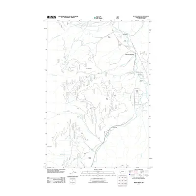
2011 Map of Burnt Ridge
USGS Topo · Published 2011About this map
Bitterroot River and its West Fork dominate this Ravalli County corridor, where the valley floor meets the rising timber of Burnt Ridge and Grouse Butte. The 2011 landscape reveals a mix of early industry and modern utility, from the site of the Comer Sawmill and the Rocci Mine to the Darby Landfill. The map details a complex network of forest access roads like Chief Joseph Trl and Muley Vista Trl, which navigate the steep drainages of Tin Cup Creek and Chaffin Creek. Local heritage is anchored in family-named landmarks such as John Ogrin Gulch, Leavens Gulch, and the residential pocket of Deer Hollow, providing a clear look at the area's rural footprint before recent mountain developments expanded. This survey serves as a precise guide to the drainage patterns and land-use markers that define the western edge of the Bitterroot Valley.
Find a feature on this map
47 named features on this map. Tap any name to fly to it.
Don’t see what you’re looking for? This feature index may not catch every label — zoom into the map to look around manually.
Map Details
Editions of this 2011 Burnt Ridge Map
This is the sole edition of this map. No revisions or reprints were ever made.
Other maps of this area

1901 · Hamilton
USGS Topo · 1:125,000

1956 · Elk City
USGS Topo · 1:250,000

1956 · Hamilton
USGS Topo · 1:250,000

1959 · Hamilton
USGS Topo · 1:250,000

1960 · Elk City
USGS Topo · 1:250,000

1960 · Hamilton
USGS Topo · 1:250,000

1964 · Hamilton
USGS Topo · 1:250,000

1964 · Burnt Ridge
USGS Topo · 1:24,000

1964 · Boulder Peak
USGS Topo · 1:24,000

1964 · Darby
USGS Topo · 1:24,000