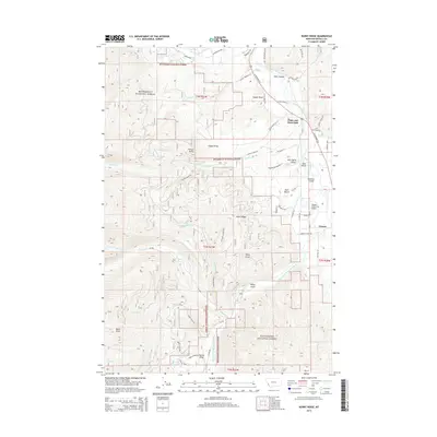
2014 Map of Burnt Ridge
USGS Topo · Published 2014About this map
Bitterroot National Forest dominates this mountain landscape, where the confluence of the West Fork Bitterroot River and the main stem of the Bitterroot River shapes the local geography. Near the small settlement of Conner, the valley floor supports the Trapper Creek Strip Airport, while the surrounding slopes are carved by numerous drainages like Chaffin Cr and Trapper Cr. The mapping of transport routes reveals a mix of modern infrastructure like US Highway 93 S alongside historic pathways such as the Chief Joseph Trl and Appaloosa Trl. This area is characterized by steep elevation changes, moving from the river banks up toward prominent features such as Burnt Ridge, Grouse Butte, and Baker Point. Land use reflects a combination of conservation and residential development, evidenced by the presence of Peaks and Pines Park nestled among the forest service boundaries.
Find a feature on this map
98 named features on this map. Tap any name to fly to it.
Don’t see what you’re looking for? This feature index may not catch every label — zoom into the map to look around manually.
Map Details
Editions of this 2014 Burnt Ridge Map
This is the sole edition of this map. No revisions or reprints were ever made.
Other maps of this area

1901 · Hamilton
USGS Topo · 1:125,000

1956 · Elk City
USGS Topo · 1:250,000

1956 · Hamilton
USGS Topo · 1:250,000

1959 · Hamilton
USGS Topo · 1:250,000

1960 · Elk City
USGS Topo · 1:250,000

1960 · Hamilton
USGS Topo · 1:250,000

1964 · Hamilton
USGS Topo · 1:250,000

1964 · Burnt Ridge
USGS Topo · 1:24,000

1964 · Boulder Peak
USGS Topo · 1:24,000

1964 · Darby
USGS Topo · 1:24,000