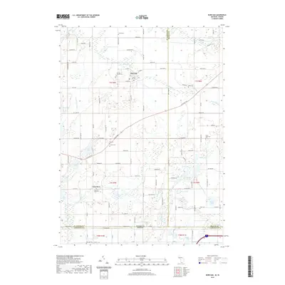
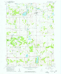
2019 Map of Burr Oak
USGS Topo · Published 2019About this map
Burr Oak serves as a primary settlement in this 2019 survey of the Michigan-Indiana borderlands, where the Prairie River winds through the northern landscape. The terrain is defined by a dense network of glacial lakes and drains, including the Sweet Lake, Cade Lake, and Honey Lake systems. These water bodies, along with the Fawn River which cuts across the southern half of the quadrangle, historically dictated the placement of early homesteads and cemeteries. Genealogists will find a high concentration of burial sites such as the Fawn River Village Cem, Sanborn Cem, and Froh Cem, indicating a long-established rural community structure. The map also records the transition from Saint Joseph County, Michigan, into LaGrange County, Indiana, marked by State Line Rd, illustrating how modern infrastructure follows the jurisdictional boundaries of the Old Northwest Territory.
Find a feature on this map
115 named features on this map. Tap any name to fly to it.
Don’t see what you’re looking for? This feature index may not catch every label — zoom into the map to look around manually.
Map Details
Editions of this 2019 Burr Oak Map
This is the sole edition of this map. No revisions or reprints were ever made.
Other maps of this area

1940 · Orland
USGS Topo · 1:24,000

1941 · Orland
USGS Topo · 1:24,000

1947 · Mongo
USGS Topo · 1:24,000

1947 · Lagrange
USGS Topo · 1:24,000

1953 · Fort Wayne
USGS Topo · 1:250,000

1956 · Fort Wayne
USGS Topo · 1:250,000
1960 · Bronson North
USGS Topo · 1:24,000
1960 · Bronson South
USGS Topo · 1:24,000
1960 · Lagrange
USGS Topo · 1:24,000
1960 · Orland
USGS Topo · 1:24,000