
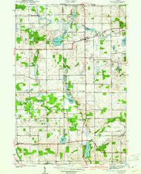
1940 Map of Orland
USGS Topo · Published 1940About this map
Orland and the surrounding borderlands between Steuben and LaGrange Counties are defined by an intricate network of kettle lakes and prairie openings mapped just before the Second World War. The settlement pattern follows the high ground between wetlands, connected by historic routes like Vistula Road and dotted with local landmarks such as the Orland Fish Hatchery. The landscape transitions from the agricultural reaches of Jackson Prairie to the chain of water bodies including Wall Lake, Otter Lake, and Deep Lake. Notable for genealogists, the map meticulously records rural community centers such as Brushy Prairie and several houses of worship including East Springfield Ch and Hopewell Ch, alongside established burying grounds like Greenlawn Cem and Carlton Cem. These features illustrate the early 20th-century development of northeastern Indiana's glacial lake region.
Find a feature on this map
36 named features on this map. Tap any name to fly to it.
Don’t see what you’re looking for? This feature index may not catch every label — zoom into the map to look around manually.
Map Details
Editions of this 1940 Orland Map
2 editions found
Other maps of this area

1941 · Orland
USGS Topo · 1:24,000

1941 · Angola West
USGS Topo · 1:24,000

1942 · Ashley
USGS Topo · 1:24,000

1942 · Angola West
USGS Topo · 1:24,000

1942 · Stroh
USGS Topo · 1:24,000

1947 · Mongo
USGS Topo · 1:24,000

1947 · Wolcottville
USGS Topo · 1:24,000

1953 · Fort Wayne
USGS Topo · 1:250,000

1956 · Fort Wayne
USGS Topo · 1:250,000

1959 · Wolcottville
USGS Topo · 1:24,000