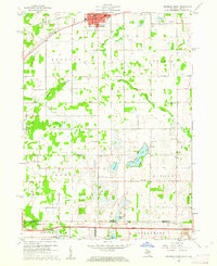
1960 Map of Bronson South
USGS Topo · Published 1961About this map
The New York Central railroad corridor anchors the northern edge of this landscape, passing through the city of Bronson, while the south is defined by the recently constructed Indiana Toll Road crossing the state line. Between these major transit routes lies a rural landscape of scattered homesteads and small townships such as Noble, Gilead, and Bethel. The terrain is marked by numerous water bodies including Gilead Lake, Mud Lake, and Anderson Lake, which are surrounded by small woodland clusters and agricultural plots.
Find a feature on this map
33 named features on this map. Tap any name to fly to it.
Don’t see what you’re looking for? This feature index may not catch every label — zoom into the map to look around manually.
Map Details
Editions of this 1960 Bronson South Map
2 editions found
Other maps of this area

1940 · Orland
USGS Topo · 1:24,000

1941 · Orland
USGS Topo · 1:24,000

1941 · Angola West
USGS Topo · 1:24,000

1942 · Angola West
USGS Topo · 1:24,000

1947 · Mongo
USGS Topo · 1:24,000

1953 · Fort Wayne
USGS Topo · 1:250,000

1956 · Fort Wayne
USGS Topo · 1:250,000

1960 · Coldwater West
USGS Topo · 1:24,000
1960 · Bronson North
USGS Topo · 1:24,000
1960 · Kinderhook
USGS Topo · 1:24,000