
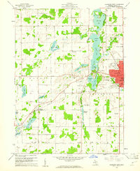
1960 Map of Coldwater West
USGS Topo · Published 1961About this map
The western edges of Coldwater and the surrounding rural townships are characterized by a prominent chain of lakes fed by the Coldwater River. This aquatic corridor, featuring Randall Lake, North Lake, Cemetery Lake, Messenger Lake, and South Lake, dictates the local geography, with the Oak Grove Cem and the County Memorial Airport occupying the land between these waters and the city center. The map reveals a transition from the urban grid of Coldwater—showing landmarks like Parkhurst Park and the Maple Lawn Hospital—to the agrarian reaches of Batavia and Ovid townships.
Find a feature on this map
62 named features on this map. Tap any name to fly to it.
Don’t see what you’re looking for? This feature index may not catch every label — zoom into the map to look around manually.
Map Details
Editions of this 1960 Coldwater West Map
2 editions found
Other maps of this area

1918 · Union City
USGS Topo · 1:62,500

1947 · Union City
USGS Topo · 1:62,500

1948 · Homer
USGS Topo · 1:62,500

1949 · Homer
USGS Topo · 1:62,500

1950 · Union City
USGS Topo · 1:62,500

1953 · Fort Wayne
USGS Topo · 1:250,000

1956 · Fort Wayne
USGS Topo · 1:250,000

1958 · Grand Rapids
USGS Topo · 1:250,000

1960 · Coldwater East
USGS Topo · 1:24,000
1960 · Bronson North
USGS Topo · 1:24,000