
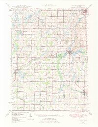
1948 Map of Homer
USGS Topo · Published 1968About this map
Homer and Tekonsha serve as the primary hubs in this mid-century portrait of southern Michigan, where the New York Central railroad corridor links small agricultural settlements. The landscape is defined by the headwaters of the St Joseph River and the Kalamazoo River, punctuated by numerous natural basins like Lyon Lake and Homer Lake. This survey illustrates the high density of rural education at the time, featuring dozens of localized schoolhouses such as Knickerbocker Sch, Dayburg Sch, and Herricksville Sch. Local industry and infrastructure are represented by Quaker Mills and the Brooks Field Airport, while the presence of Shooks Prairie Cem and West Eckford Cem provides critical points of interest for genealogical research in Calhoun, Branch, and Hillsdale Counties.
Find a feature on this map
102 named features on this map. Tap any name to fly to it.
Don’t see what you’re looking for? This feature index may not catch every label — zoom into the map to look around manually.
Map Details
Editions of this 1948 Homer Map
2 editions found
Other maps of this area

1918 · Battle Creek
USGS Topo · 1:62,500

1918 · Union City
USGS Topo · 1:62,500

1919 · Springport
USGS Topo · 1:62,500

1921 · Springport
USGS Topo · 1:62,500

1921 · Marshall
USGS Topo · 1:62,500

1923 · Marshall
USGS Topo · 1:62,500

1943 · Battle Creek
USGS Topo · 1:62,500

1943 · Marshall
USGS Topo · 1:62,500

1947 · Ceresco
USGS Topo · 1:24,000

1947 · Union City
USGS Topo · 1:62,500