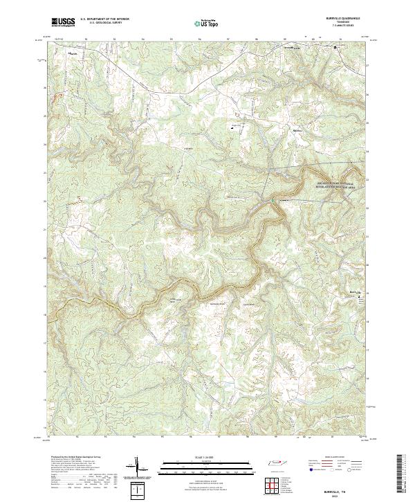
2022 Map of Burrville
USGS Topo · Published 2022About this map
Allardt and Armathwaite anchor the northern reaches of this plateau landscape, where the headwaters of the Clear Fork and its various prongs carve deep into the terrain. The map documents the boundary between Fentress Co and Morgan Co, following the natural winding course of the river south of Underwood Neck. To the east, the Big South Fork National River and Recreation Area encompasses the drainage of Skull Cave Cr and Still Camp Br. Settlement patterns are defined by high-ground ridges and the historical influence of roads like Rugby Pike. Local history is preserved in several family and community burial grounds, including Fellowship Cem near the northern border and Mount Vernon Cem adjacent to Burrville. Significant landforms such as Iron Mtn, Galloway Knob, and Lyons Knob dominate the central topography, providing context for the early surveying and development of this section of the Cumberland Plateau.
Find a feature on this map
44 named features on this map. Tap any name to fly to it.
Don’t see what you’re looking for? This feature index may not catch every label — zoom into the map to look around manually.
Map Details
Editions of this 2022 Burrville Map
This is the sole edition of this map. No revisions or reprints were ever made.
Other maps of this area

1895 · Wartburg
USGS Topo · 1:125,000

1896 · Wartburg
USGS Topo · 1:125,000

1935 · Pilot Mountain
USGS Topo · 1:24,000

1936 · Twin Bridges
USGS Topo · 1:24,000

1936 · Jones Knob
USGS Topo · 1:24,000

1943 · Twin Bridges
USGS Topo · 1:24,000
1945 · Twin Bridges
USGS Topo · 1:24,000
1946 · Pilot Mountain
USGS Topo · 1:24,000
1949 · Jones Knob
USGS Topo · 1:24,000

1952 · Honey Creek
USGS Topo · 1:24,000