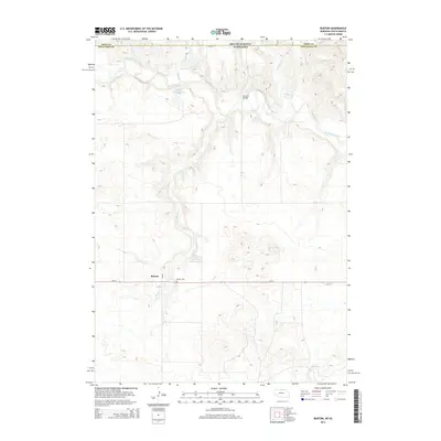
2014 Map of Burton
USGS Topo · Published 2014About this map
The small settlement of Burton serves as the focal point of this rural Keya Paha County landscape, situated along the east-west corridor of Ne-12. This 2014 survey reveals a transition from the agricultural plateaus in the south toward the dissected drainage systems of the north. The winding Keya Paha River cuts across the northern border, where Leavens Bridge provides a vital crossing near the state line.
Find a feature on this map
16 named features on this map. Tap any name to fly to it.
Don’t see what you’re looking for? This feature index may not catch every label — zoom into the map to look around manually.
Map Details
Editions of this 2014 Burton Map
This is the sole edition of this map. No revisions or reprints were ever made.
Other maps of this area

1949 · Jamison SW
USGS Topo · 1:24,000

1951 · Jamison SW
USGS Topo · 1:24,000

1955 · Mitchell
USGS Topo · 1:250,000

1955 · O'Neill
USGS Topo · 1:250,000

1959 · O'Neill
USGS Topo · 1:250,000

1959 · Mitchell
USGS Topo · 1:250,000

1964 · Dallas SW
USGS Topo · 1:24,000

1964 · Mills
USGS Topo · 1:24,000
1964 · Springview
USGS Topo · 1:24,000

1964 · Paxton
USGS Topo · 1:24,000