Old Maps of Tripp County, South Dakota
Explore 234 old maps of Tripp County, spanning from 1950 to today. These high-resolution historic maps reveal how streets, neighborhoods, landmarks, and natural features evolved over time — perfect for genealogy, metal detecting, research, and local history exploration.
What you can do with these maps:
- See how Tripp County changed over time: Compare historical maps to modern-day views to trace roads, homesites, rail lines & more.
- View detailed metadata: Each map includes creators, publishers, year, scale, and archive source.
- Overlay maps with satellite & LiDAR: Visualize the past alongside modern tools to explore terrain & human change.
- Trusted historical sources: Maps sourced from the USGS, Library of Congress, and other archives.
- Access maps your way: View online, download high-res files, or order prints for personal or research use.
Start exploring old maps of Tripp County to uncover forgotten places, hidden landmarks, and the deep history beneath your feet.
Tripp County, SD maps
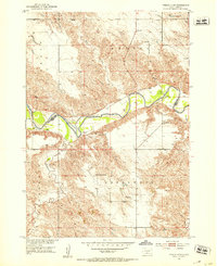
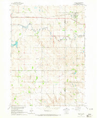
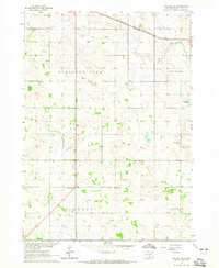
(234)- 1950 Map of Norden
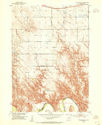
 1950 Norden1950 Print · USGSThe Niobrara River valley in the early fifties shows a rugged landscape of family-run cattle operations and scattered rural school districts. Genealogists can locate family holdings like Worth Ranch or McMara Ranch and burial sites at Sparks Cem.2 unique versions available
 - 1951 Map of Presho 4 NE, 1953 Print
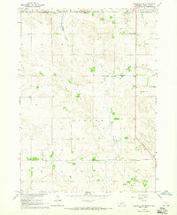
 1951 Presho 4 NE1953 Print · USGSThe White River valley in the early fifties shows a remote landscape of prairie townships divided between Lyman and Tripp counties. Local historians can trace the foundations of rural life at sites like Holy Rosary Ch, North Greenwood Sch, and the winding Mission Creek.4 unique versions available
 - 1951 Map of Ideal NW, 1953 Print
 1951 Ideal NW1953 Print · USGSThe rural breaks of the White River valley are captured here in the early fifties during the development of the Missouri River Basin. Genealogists and local historians can trace family land near the Christensen Ranch or locate the Nelson Sch (Abandoned) and Edna Sch.2 unique versions available
 - 1951 Map of Ideal NE, 1953 Print
 1951 Ideal NE1953 Print · USGSThe White River meanders through the Lyman and Tripp county line during the early fifties, showing the rural structure of the Missouri River Basin. Genealogists can locate landmarks like Red Hill Ch, Red Hill Cem, and the Lone Star Sch among the breaks of the White River.2 unique versions available
 - 1951 Map of Presho 4 NW, 1953 Print
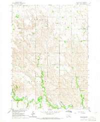
 1951 Presho 4 NW1953 Print · USGSThe White River breaks of South Dakota are captured in the early fifties during a period of Missouri River Basin development. Genealogists and local historians can trace isolated homesteads such as Krutson Ranch and Iverson Ranch or the location of the Pleasant Hill Sch.4 unique versions available
 - 1952 Map of Norden
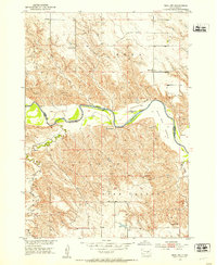
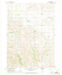
 1952 Norden1952 Print · USGSKeya Paha and Brown counties meet along the winding Niobrara River in the early fifties, capturing a period of transition for Nebraska's ranching country. Genealogists can trace family footprints at Norden, Sparks Cem, and numerous schoolhouses from Rockford Sch to School No 74.
 - 1952 Map of Reliance SW, 1954 Print
 1952 Reliance SW1954 Print · USGSLyman County ranch lands meet the winding White River in the early fifties, showing a rural community defined by its remote schools and rugged terrain. Genealogists can locate family landmarks like the Nelson Ranch, Roosevelt Sch, and Trinity Cem.3 unique versions available
 - 1952 Map of Hamill NW, 1954 Print
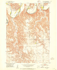 1952 Hamill NW1954 Print · USGSThe ranchlands of Tripp and Lyman County are captured here in the early 1950s as the Missouri River Basin development program began. Researchers can trace historic family holdings like the Schooler Ranch or locate vanished rural schoolhouses such as Bellwood Sch and Gassman Sch.2 unique versions available
 - 1952 Map of Hamill NE, 1954 Print
 1952 Hamill NE1954 Print · USGSLyman County settlement along the White River is documented here in the early fifties, just as the regional landscape was being reshaped. Genealogists can locate family-named school sites like Lindgren Sch and Walcott Sch before the Missouri River Basin development.
 - 1955 Map of Martin, 1968 Print
 1955 Martin1968 Print · USGSTribal lands and rail corridors define the South Dakota plains in the mid-fifties, from the sand hills to the badlands. Genealogists and historians can trace the early layout of Pine Ridge Indian Reservation settlements and find small rail towns like Stamford and Witten.2 unique versions available
 - 1955 Map of Mitchell, 1973 Print
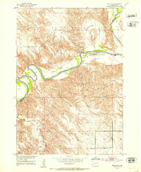
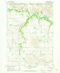
 1955 Mitchell1973 Print · USGSThe Missouri River valley undergoes a massive transformation in the mid-1950s as the Fort Randall Dam creates Lake Francis Case. You can trace the rail lines of the Chicago Milwaukee St Paul and Pacific through Mitchell or locate local landmarks like Butler Town Hall.2 unique versions available
 - 1955 Map of O'Neill, 1974 Print
 1955 O'Neill1974 Print · USGSNorth-central Nebraska in the 1950s reveals a vast cattle-ranching landscape transitioning from the Missouri River breaks to the iconic Sand Hills. Researchers can trace the path of the Chicago and North Western rail line and locate rural landmarks like the Dustin Post Office and St Johns Lake Ch.2 unique versions available
 - 1957 Map of Valentine, 1960 Print
 1957 Valentine1960 Print · USGSNorthern Nebraska's ranching country and the vast Sand Hills are detailed here in the late fifties. Genealogists and historians can locate numerous family-named landmarks like the Dahlgren Ranch and trace the path of the Chicago and North Western railroad through Valentine.3 unique versions available
 - 1958 Map of Martin
 1958 Martin1958 Print · USGSSouth Dakota's southern plains are documented here in the late fifties, showing the expansive Pine Ridge and Rosebud Indian Reservations. Genealogists and historians can locate early settlements along the Chicago Milwaukee St Paul and Pacific line or find family roots near Martin and the Indian Cemetery.
 - 1959 Map of Valentine
 1959 Valentine1959 Print · USGSThe northern Nebraska Sand Hills are captured here in the late fifties, showcasing a vast ranching landscape shaped by the Niobrara and Loup rivers. Genealogists and historians can trace rail-town development along the Chicago and North Western and locate remote outposts like Brownlee or Kennedy.
 - 1959 Map of O'Neill
 1959 O'Neill1959 Print · USGSNorth-central Nebraska in the late fifties is defined by the vast Sand Hills and the vital Chicago and North Western rail line. Genealogists and researchers can trace family roots through settlements like Atkinson, Bassett, and Stuart or follow the waters of the Niobrara River.2 unique versions available
 - 1959 Map of Mitchell
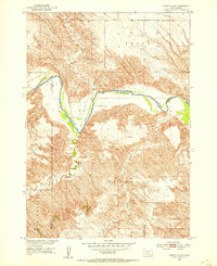
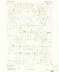
 1959 Mitchell1959 Print · USGSSouth Dakota’s river and rail corridors come alive in the late fifties as the Missouri River valley undergoes dramatic change. Genealogists and historians can trace family roots through numerous small towns and schools such as Academy, Stickney, and Gregory.2 unique versions available
 - 1964 Map of Dallas SW, 1965 Print
 1964 Dallas SW1965 Print · USGSThe Keya Paha River country of south-central South Dakota appears here in the mid-1960s, showing a landscape of remote townships and prairie creeks. Genealogists can trace rural family sites near Gibson Cem, Free Methodist Ch, and Highland Sch.
 - 1964 Map of Meadville NW, 1965 Print
 1964 Meadville NW1965 Print · USGSThe Nebraska and South Dakota borderlands are shown here in the mid-1960s, featuring ranching life and rural school districts. Researchers can locate the Heerten Cem and trace old cattle lands at Schroeder Ranch or find the Lost Creek Sch.
 - 1964 Map of Dallas, 1965 Print
 1964 Dallas1965 Print · USGSGregory County in the mid-1960s reveals a structured prairie landscape centered on the rail-side town of Dallas. Local historians and genealogists can trace the distribution of early rural education through sites like Melrose Sch, North Lincoln Sch, and Pleasant Valley Sch.
 - 1964 Map of Paxton, 1965 Print
 1964 Paxton1965 Print · USGSTripp and Gregory Counties are captured here in the mid-sixties, showcasing a landscape of small-town centers and distributed rural school districts. Genealogists can trace family footprints near Paxton, the Paxton Church, and several local landmarks like South Lincoln Sch.
 - 1964 Map of Burton, 1965 Print
 1964 Burton1965 Print · USGSThe Nebraska-South Dakota borderlands come into focus in the mid-1960s, showing the intersection of the Rosebud Reservation and rural Keya Paha County. Genealogists and researchers can trace the community around Burton, identifying local family landmarks like the Burton Cem and Roadside Sch.
 - 1964 Map of Springview NW, 1965 Print
 1964 Springview NW1965 Print · USGSThe Keya Paha River valley at the Nebraska and South Dakota border comes into focus in this mid-1960s survey. Researchers can trace rural landmarks and family sites like Kenaston Cem, Jordan Sch, and the Rosebud Indian Reservation Boundary.
 - 1964 Map of Dallas NW, 1965 Print
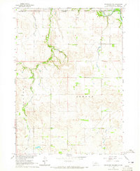
 1964 Dallas NW1965 Print · USGSThe Tripp County prairie in the mid-1960s shows a landscape of steady agricultural settlement and rail infrastructure. Genealogists and local historians can trace community life through the Kansas Flat Sch, Calvary Chapel, and the path of the Chicago and North Western railroad.2 unique versions available
 - 1964 Map of Meadville NE, 1965 Print
 1964 Meadville NE1965 Print · USGSThe Nebraska-South Dakota borderlands come into focus in the mid-1960s, showing a landscape shaped by ranching and the Rosebud Indian Reservation. Genealogists and local historians can locate the Gierau Ranch, Liberty School, and the remote Patterson Landing Field.
Showing maps 1-25 of 234
Top cities of Tripp County
- Winner historical maps
- Colome historical maps
- Ideal Segment historical maps
- Ideal historical maps
- Carter historical maps
- Millboro historical maps
See more
Frequently asked questions
- What are the different types of historical maps available for Tripp County?
- What is the oldest map of Tripp County?
- Where can I purchase historical maps of Tripp County for my home or office?
- Where can I download high-res historical maps of Tripp County?
- Are there historical topographic maps available for Tripp County?
- Is there historical aerial imagery available for Tripp County?
- Where are historical maps of Tripp County sourced from?