1960s Maps of Tripp County, South Dakota
Explore 9 historic maps of Tripp County from the 1960s. These maps offer a rare glimpse into what life looked like during the 1960s — showing old roads, neighborhoods, homes, and landmarks that have changed or disappeared over time.
Whether you're researching your family's past, planning a metal detecting trip, or studying how Tripp County's landscape evolved across the 1960s, these high-resolution maps are a powerful tool for exploring the history of this region.
- Focus on a specific era: All maps on this page are from the 1960s, giving you a focused view of this time period.
- See what’s changed: Compare century-old streets, trails, and buildings to today's modern landscape using overlays and satellite layers.
- Research with precision: Use these maps for genealogy, historical research, land use analysis, or educational projects.
- View, download, or print: Maps are fully viewable online in high resolution, and can be downloaded or printed for your own records.
Start exploring Tripp County's history through authentic maps from the 1960s. This is your window into the past.
Tripp County, SD maps
(9)- 1964 Map of Dallas SW, 1965 Print
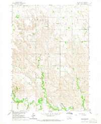 1964 Dallas SW1965 Print · USGSThe Keya Paha River country of south-central South Dakota appears here in the mid-1960s, showing a landscape of remote townships and prairie creeks. Genealogists can trace rural family sites near Gibson Cem, Free Methodist Ch, and Highland Sch.
 - 1964 Map of Meadville NW, 1965 Print
 1964 Meadville NW1965 Print · USGSThe Nebraska and South Dakota borderlands are shown here in the mid-1960s, featuring ranching life and rural school districts. Researchers can locate the Heerten Cem and trace old cattle lands at Schroeder Ranch or find the Lost Creek Sch.
 - 1964 Map of Dallas, 1965 Print
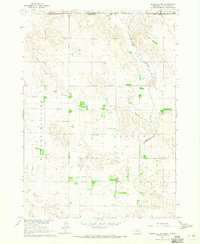
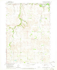
 1964 Dallas1965 Print · USGSGregory County in the mid-1960s reveals a structured prairie landscape centered on the rail-side town of Dallas. Local historians and genealogists can trace the distribution of early rural education through sites like Melrose Sch, North Lincoln Sch, and Pleasant Valley Sch.
 - 1964 Map of Paxton, 1965 Print
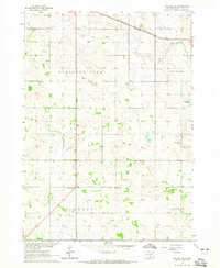
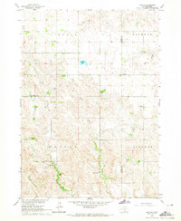 1964 Paxton1965 Print · USGSTripp and Gregory Counties are captured here in the mid-sixties, showcasing a landscape of small-town centers and distributed rural school districts. Genealogists can trace family footprints near Paxton, the Paxton Church, and several local landmarks like South Lincoln Sch.
 - 1964 Map of Burton, 1965 Print
 1964 Burton1965 Print · USGSThe Nebraska-South Dakota borderlands come into focus in the mid-1960s, showing the intersection of the Rosebud Reservation and rural Keya Paha County. Genealogists and researchers can trace the community around Burton, identifying local family landmarks like the Burton Cem and Roadside Sch.
 - 1964 Map of Springview NW, 1965 Print
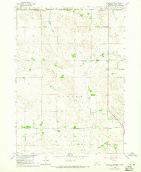
 1964 Springview NW1965 Print · USGSThe Keya Paha River valley at the Nebraska and South Dakota border comes into focus in this mid-1960s survey. Researchers can trace rural landmarks and family sites like Kenaston Cem, Jordan Sch, and the Rosebud Indian Reservation Boundary.
 - 1964 Map of Dallas NW, 1965 Print
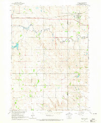
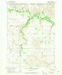
 1964 Dallas NW1965 Print · USGSThe Tripp County prairie in the mid-1960s shows a landscape of steady agricultural settlement and rail infrastructure. Genealogists and local historians can trace community life through the Kansas Flat Sch, Calvary Chapel, and the path of the Chicago and North Western railroad.2 unique versions available
 - 1964 Map of Meadville NE, 1965 Print
 1964 Meadville NE1965 Print · USGSThe Nebraska-South Dakota borderlands come into focus in the mid-1960s, showing a landscape shaped by ranching and the Rosebud Indian Reservation. Genealogists and local historians can locate the Gierau Ranch, Liberty School, and the remote Patterson Landing Field.
 - 1969 Map of O'Neill
 1969 O'Neill1969 Print · USGSCentral Nebraska in the mid-fifties is defined here by the expansive Sand Hills and the winding Niobrara River. Trace the Chicago and North Western rail line through cattle towns like O'Neill and Ainsworth.
End of results
Showing maps 1-9 of 9
Top cities of Tripp County
- Winner historical maps
- Colome historical maps
- Ideal Segment historical maps
- Ideal historical maps
- Carter historical maps
- Millboro historical maps
See more
Frequently asked questions
- What are the different types of historical maps available for Tripp County?
- What is the oldest map of Tripp County?
- Where can I purchase historical maps of Tripp County for my home or office?
- Where can I download high-res historical maps of Tripp County?
- Are there historical topographic maps available for Tripp County?
- Is there historical aerial imagery available for Tripp County?
- Where are historical maps of Tripp County sourced from?