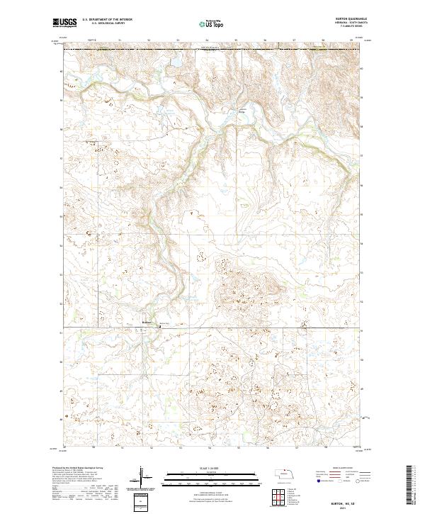
2021 Map of Burton
USGS Topo · Published 2021About this map
Burton is the primary settlement in this northern Nebraska landscape, situated near the headwaters of Burton Cr. The township sits just south of the border with South Dakota, marked by the line between Keya Paha Co and the counties of Tripp Co and Gregory Co. The terrain is defined by the winding course of the Keya Paha River, which is spanned by the notable Leavens Bridge to the north of the main village. For genealogists and local historians, the Burton Cem is a central landmark located just east of the town center. The landscape is dotted with water features such as Nilson Reservoir and Eagles Nest Lake, reflecting the drainage patterns of Lute Cr and Buffalo Cr as they feed into the larger river system during the modern era.
Find a feature on this map
22 named features on this map. Tap any name to fly to it.
Don’t see what you’re looking for? This feature index may not catch every label — zoom into the map to look around manually.
Map Details
Editions of this 2021 Burton Map
This is the sole edition of this map. No revisions or reprints were ever made.
Other maps of this area

1949 · Jamison SW
USGS Topo · 1:24,000

1951 · Jamison SW
USGS Topo · 1:24,000

1955 · Mitchell
USGS Topo · 1:250,000

1955 · O'Neill
USGS Topo · 1:250,000

1959 · O'Neill
USGS Topo · 1:250,000

1959 · Mitchell
USGS Topo · 1:250,000

1964 · Dallas SW
USGS Topo · 1:24,000

1964 · Mills
USGS Topo · 1:24,000
1964 · Springview
USGS Topo · 1:24,000

1964 · Paxton
USGS Topo · 1:24,000