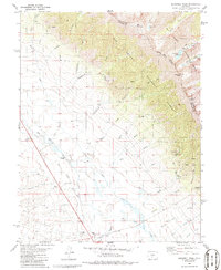
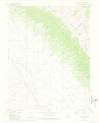
1981 Map of Bushnell Peak
USGS Topo · Published 1986About this map
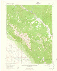
High peaks and alpine drainages dominate this 1980s-era study of the boundary between the Rio Grande National Forest and San Isabel National Forest. Rising over the terrain are Bushnell Peak and Mount Otto, marking the divide between Saguache Co and Fremont Co. The high-altitude landscape is dotted with numerous small prospects and alpine water bodies like the Stout Creek Lakes and Bushnell Lakes, reflecting the area's history of mineral exploration and glacial sculpting.
Find a feature on this map
39 named features on this map. Tap any name to fly to it.
Don’t see what you’re looking for? This feature index may not catch every label — zoom into the map to look around manually.
Map Details
Editions of this 1981 Bushnell Peak Map
2 editions found
Other maps of this area
1950 · Valley View Hot Springs
USGS Topo · 1:24,000

1954 · Pueblo
USGS Topo · 1:250,000

1956 · Montrose
USGS Topo · 1:250,000

1957 · Pueblo
USGS Topo · 1:250,000

1958 · Pueblo
USGS Topo · 1:250,000

1959 · Montrose
USGS Topo · 1:250,000
1959 · Bonanza
USGS Topo · 1:62,500
1959 · Howard
USGS Topo · 1:62,500

1960 · Montrose
USGS Topo · 1:250,000

1962 · Pueblo
USGS Topo · 1:250,000