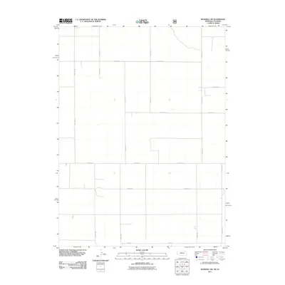
2011 Map of Bushnell SW
USGS Topo · Published 2011About this map
The High Plains borderland where Colorado meets Nebraska defines this landscape, characterized by a strictly organized grid of agricultural and boundary roads. The north-south State Line Rd serves as the primary survey anchor, marking the division between the two states. This 2011 survey by the U.S. Geological Survey illustrates a sparsely populated region of Weld County where the land is partitioned into large sections. Local movement is facilitated by a network of numbered routes including County Rd-8, County Rd-12, and County Rd-17. At the southern edge, Co Rd 140 cuts across the terrain, showing the persistence of the Public Land Survey System in shaping the modern infrastructure of this rural interior.
Find a feature on this map
12 named features on this map. Tap any name to fly to it.
Don’t see what you’re looking for? This feature index may not catch every label — zoom into the map to look around manually.
Map Details
Editions of this 2011 Bushnell SW Map
This is the sole edition of this map. No revisions or reprints were ever made.
Other maps of this area

1954 · Sterling
USGS Topo · 1:250,000

1954 · Scottsbluff
USGS Topo · 1:250,000

1954 · Cheyenne
USGS Topo · 1:250,000

1954 · Greeley
USGS Topo · 1:250,000

1957 · Greeley
USGS Topo · 1:250,000

1958 · Cheyenne
USGS Topo · 1:250,000

1958 · Greeley
USGS Topo · 1:250,000

1958 · Scottsbluff
USGS Topo · 1:250,000

1958 · Sterling
USGS Topo · 1:250,000

1961 · Greeley
USGS Topo · 1:250,000