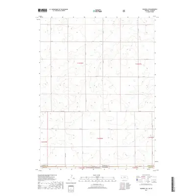
2017 Map of Bushnell SW
USGS Topo · Published 2017About this map
Pawnee National Grassland dominates the southern portion of this landscape, marking a protected expanse of the High Plains where the Colorado and Nebraska borders meet. This survey reveals a strictly organized section-line road network that defines the rural character of Weld Co, Colorado, and Kimball Co, Nebraska. The border itself is traced by State Line Rd, a literal boundary marker in a region of high-elevation prairie and rolling terrain. The map is primarily characterized by its vast open spaces and sparse infrastructure, consisting mostly of county routes like Co Rd 140 and Co Rd 16. The lack of concentrated settlements highlights the area's dedication to conservation and large-scale ranching, with the topography subtly shifting between various township and range divisions such as t13n r58w and t12n r58w.
Find a feature on this map
23 named features on this map. Tap any name to fly to it.
Don’t see what you’re looking for? This feature index may not catch every label — zoom into the map to look around manually.
Map Details
Editions of this 2017 Bushnell SW Map
This is the sole edition of this map. No revisions or reprints were ever made.
Other maps of this area

1954 · Sterling
USGS Topo · 1:250,000

1954 · Scottsbluff
USGS Topo · 1:250,000

1954 · Cheyenne
USGS Topo · 1:250,000

1954 · Greeley
USGS Topo · 1:250,000

1957 · Greeley
USGS Topo · 1:250,000

1958 · Cheyenne
USGS Topo · 1:250,000

1958 · Greeley
USGS Topo · 1:250,000

1958 · Scottsbluff
USGS Topo · 1:250,000

1958 · Sterling
USGS Topo · 1:250,000

1961 · Greeley
USGS Topo · 1:250,000