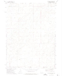
1972 Map of Bushnell SW
USGS Topo · Published 1974About this map
An expansive Oil Field dominates this 1970s landscape where the High Plains transition across the State Line. This survey documents the energy infrastructure of the era, recording numerous instances of an Oil Well and an extensive Pipeline network that cuts across the terrain. The map serves as a precise record of the jurisdictional boundary where Kimball Co and Weld Co meet at the Nebraska Colorado border. Outside of the industrial footprints, the landscape is sparsely marked by a lone Well, reflecting a region defined primarily by its subterranean resources and the straight-line geography of state and county divisions.
Find a feature on this map
7 named features on this map. Tap any name to fly to it.
Don’t see what you’re looking for? This feature index may not catch every label — zoom into the map to look around manually.
Map Details
Editions of this 1972 Bushnell SW Map
This is the sole edition of this map. No revisions or reprints were ever made.
Other maps of this area

1954 · Sterling
USGS Topo · 1:250,000

1954 · Scottsbluff
USGS Topo · 1:250,000

1954 · Cheyenne
USGS Topo · 1:250,000

1954 · Greeley
USGS Topo · 1:250,000

1957 · Greeley
USGS Topo · 1:250,000

1958 · Cheyenne
USGS Topo · 1:250,000

1958 · Greeley
USGS Topo · 1:250,000

1958 · Scottsbluff
USGS Topo · 1:250,000

1958 · Sterling
USGS Topo · 1:250,000

1961 · Greeley
USGS Topo · 1:250,000