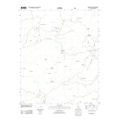
2012 Map of Butler Peak
USGS Topo · Published 2012About this map
Hawes Ranch sits at the center of this high-elevation landscape, where a network of forest roads and springs connects the high peaks of the San Bernardino Mountains. The map details a transition from the southern summits of Butler Peak and Crafts Peak toward the northern flats and canyons. This area has long served as a corridor for movement between the higher timberlands and the desert floor, evidenced by the many named springs such as Chukar Spring and Lizard Spring that sustain the local ecology.
Find a feature on this map
94 named features on this map. Tap any name to fly to it.
Don’t see what you’re looking for? This feature index may not catch every label — zoom into the map to look around manually.
Map Details
Editions of this 2012 Butler Peak Map
This is the sole edition of this map. No revisions or reprints were ever made.
Other maps of this area

1899 · Redlands
USGS Topo · 1:62,500

1901 · Southern California Sheet No. 1
USGS Topo · 1:250,000

1901 · Redlands
USGS Topo · 1:62,500

1902 · Deep Creek
USGS Topo · 1:62,500

1902 · San Gorgonio
USGS Topo · 1:125,000

1904 · Southern California Sheet No. 1
USGS Topo · 1:250,000

1947 · Lucerne Valley
USGS Topo · 1:62,500

1949 · Lucerne Valley
USGS Topo · 1:62,500

1953 · San Bernardino
USGS Topo · 1:250,000
1953 · Harrison Mtn.
USGS Topo · 1:24,000