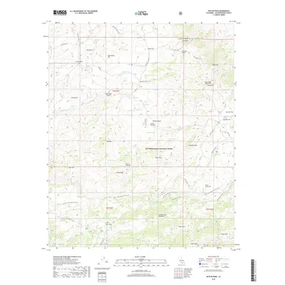
2018 Map of Butler Peak
USGS Topo · Published 2018About this map
San Bernardino National Forest encompasses this high-altitude landscape, where numerous natural springs supported early mountain ranching and travel. This 2018 survey documents a dense network of water sources, from Cienega Larga to Jackrabbit Spring, which have long been vital for regional ecology and human settlement. The map highlights the high-elevation flats that once served as crucial grazing and homesteading sites, including Big Pine Flat, Coxey Meadow, and Carbine Flat.
Find a feature on this map
79 named features on this map. Tap any name to fly to it.
Don’t see what you’re looking for? This feature index may not catch every label — zoom into the map to look around manually.
Map Details
Editions of this 2018 Butler Peak Map
This is the sole edition of this map. No revisions or reprints were ever made.
Other maps of this area

1899 · Redlands
USGS Topo · 1:62,500

1901 · Southern California Sheet No. 1
USGS Topo · 1:250,000

1901 · Redlands
USGS Topo · 1:62,500

1902 · Deep Creek
USGS Topo · 1:62,500

1902 · San Gorgonio
USGS Topo · 1:125,000

1904 · Southern California Sheet No. 1
USGS Topo · 1:250,000

1947 · Lucerne Valley
USGS Topo · 1:62,500

1949 · Lucerne Valley
USGS Topo · 1:62,500

1953 · San Bernardino
USGS Topo · 1:250,000
1953 · Harrison Mtn.
USGS Topo · 1:24,000