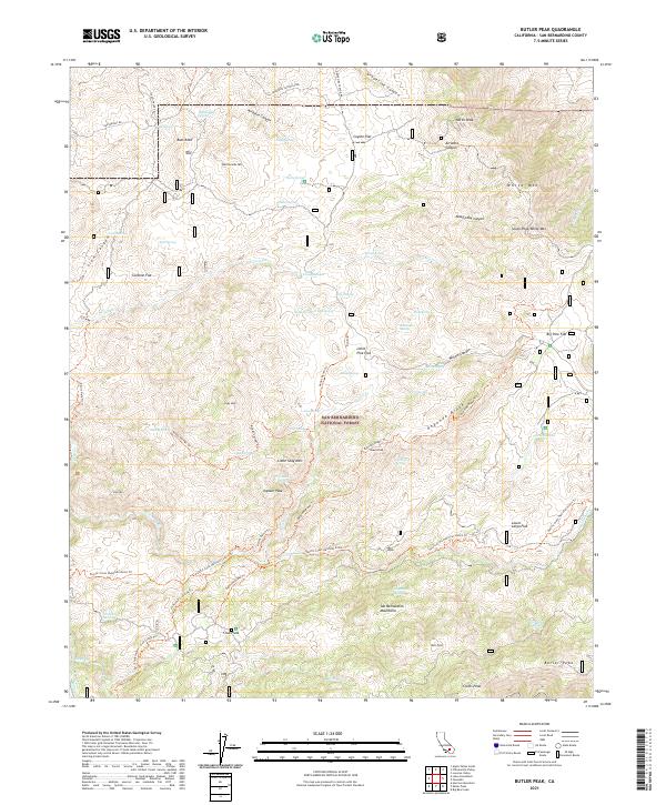
2021 Map of Butler Peak
USGS Topo · Published 2021About this map
San Bernardino National Forest encompasses this high-elevation landscape, where the rugged topography of the San Bernardino Mountains is defined by a dense network of springs and canyons. The Deep Creek Wild and Scenic River carves through the southern portion of the map, serving as a primary drainage for the surrounding peaks. Historical travel and modern recreation converge along the Pacific Crest National Scenic Trl and the Holcomb Crossing Trl, which navigate the steep terrain between prominent landmarks like Butler Peak and Shay Mtn.
Find a feature on this map
75 named features on this map. Tap any name to fly to it.
Don’t see what you’re looking for? This feature index may not catch every label — zoom into the map to look around manually.
Map Details
Editions of this 2021 Butler Peak Map
This is the sole edition of this map. No revisions or reprints were ever made.
Other maps of this area

1899 · Redlands
USGS Topo · 1:62,500

1901 · Southern California Sheet No. 1
USGS Topo · 1:250,000

1901 · Redlands
USGS Topo · 1:62,500

1902 · Deep Creek
USGS Topo · 1:62,500

1902 · San Gorgonio
USGS Topo · 1:125,000

1904 · Southern California Sheet No. 1
USGS Topo · 1:250,000

1947 · Lucerne Valley
USGS Topo · 1:62,500

1949 · Lucerne Valley
USGS Topo · 1:62,500

1953 · San Bernardino
USGS Topo · 1:250,000
1953 · Harrison Mtn.
USGS Topo · 1:24,000