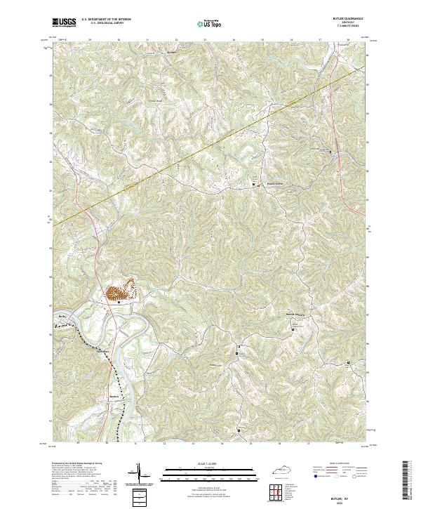
2022 Map of Butler
USGS Topo · Published 2022About this map
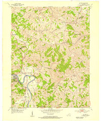
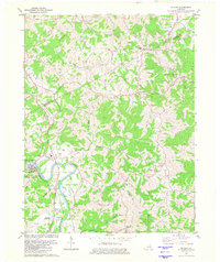
The Licking River carves a deep valley through the northern Kentucky landscape, serving as a primary corridor for the communities of Butler, Meridian, and Boston. The terrain is defined by a dense network of branching ridges and hollows, such as Fisher Ridge, where small rural settlements like Kohler and Peach Grove maintain their positions atop the high ground. The survey reveals a significant genealogical record through its numerous burial sites, including the Immaculate Conception Church Cem and Norris Cem, which anchor the various townships. Transportation follows the natural contours, with routes like Alexandria Pike and Peach Grove Rd connecting the upland farms to the river valley. The intricate drainage pattern of Twentymile Cr and Flour Cr further illustrates the complex local geography where Campbell and Pendleton counties meet.
Find a feature on this map
103 named features on this map. Tap any name to fly to it.
Don’t see what you’re looking for? This feature index may not catch every label — zoom into the map to look around manually.
Map Details
Editions of this 2022 Butler Map
This is the sole edition of this map. No revisions or reprints were ever made.
Historical Maps of Mount Auburn Through Time
3 maps found