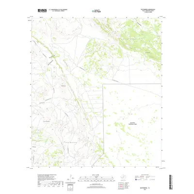
2019 Map of Butterbowl
USGS Topo · Published 2019About this map
Santiago Mountains and the Chalk Mountains dominate this Brewster County landscape, defining a region of stark elevation changes and dry drainage systems. The small settlement of Butterbowl sits at a crossroads of unpaved routes like Cedar Springs Rd, serving as a remote outpost in the high desert. To the east, the boundary of Big Bend National Park carves through the terrain, protecting the area's distinct natural features.
Find a feature on this map
20 named features on this map. Tap any name to fly to it.
Don’t see what you’re looking for? This feature index may not catch every label — zoom into the map to look around manually.
Map Details
Editions of this 2019 Butterbowl Map
This is the sole edition of this map. No revisions or reprints were ever made.
Other maps of this area

1917 · Santiago Peak
USGS Topo · 1:62,500

1917 · Bone Spring
USGS Topo · 1:62,500

1917 · Hood Spring
USGS Topo · 1:62,500

1918 · Bone Spring
USGS Topo · 1:125,000

1918 · Hood Spring
USGS Topo · 1:62,500

1918 · Santiago Peak
USGS Topo · 1:62,500

1918 · Bone Spring
USGS Topo · 1:62,500

1918 · Nine Point Mesa
USGS Topo · 1:62,500

1920 · Bone Spring
USGS Topo · 1:62,500

1931 · Hood Spring
USGS Topo · 1:62,500