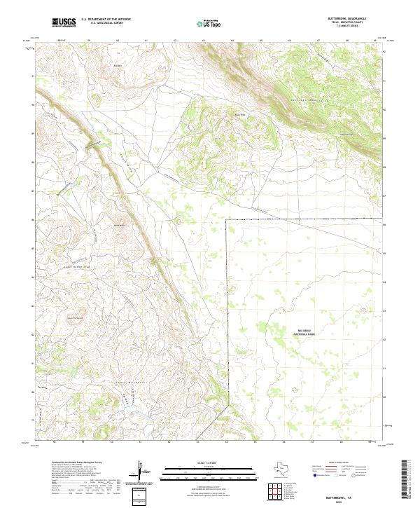
2022 Map of Butterbowl
USGS Topo · Published 2022About this map
Big Bend National Park encompasses the eastern portion of this high-desert landscape in Brewster County, where the topography is defined by the convergence of several significant mountain groups and drainage systems. The Santiago Mountains dominate the northeastern sector, separated from the Black Hills by the notable Javelina Gap. To the south, the Chalk Mountains rise near the headwaters of Cedar Creek, while the central basin features the distinct landform known as Butterbowl. This modern survey illustrates the sparse but critical infrastructure of the Trans-Pecos region, centered on the Chalk Draw Ranch Rd and Cedar Springs Rd networks. These routes follow natural corridors between the peaks, tracing the same paths that have connected remote ranching outposts and springs like Cedar Spring for generations.
Find a feature on this map
22 named features on this map. Tap any name to fly to it.
Don’t see what you’re looking for? This feature index may not catch every label — zoom into the map to look around manually.
Map Details
Editions of this 2022 Butterbowl Map
This is the sole edition of this map. No revisions or reprints were ever made.
Other maps of this area

1917 · Santiago Peak
USGS Topo · 1:62,500

1917 · Bone Spring
USGS Topo · 1:62,500

1917 · Hood Spring
USGS Topo · 1:62,500

1918 · Bone Spring
USGS Topo · 1:125,000

1918 · Hood Spring
USGS Topo · 1:62,500

1918 · Santiago Peak
USGS Topo · 1:62,500

1918 · Bone Spring
USGS Topo · 1:62,500

1918 · Nine Point Mesa
USGS Topo · 1:62,500

1920 · Bone Spring
USGS Topo · 1:62,500

1931 · Hood Spring
USGS Topo · 1:62,500