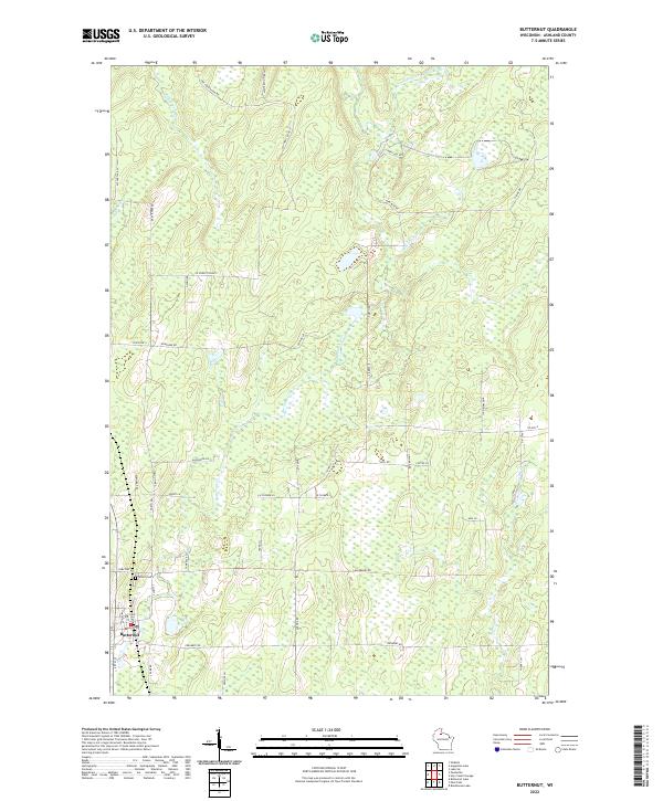
2022 Map of Butternut
USGS Topo · Published 2022About this map
Butternut sits at the southwestern edge of this landscape, characterized by a complex network of wetlands and small waterways in northern Wisconsin. The village is organized around a grid including Main St and S Hay St, with Union Cem located just to the north along Cemetery Rd. The surrounding terrain is defined by the winding course of Butternut Creek and Hay Creek, which drain a heavily forested region marked by numerous fire lanes and local roads like Masterson Fire Ln and Pine Plantation Rd. In the northeast, the E Fork Chippewa River cuts through the township, reflecting the drainage patterns that have historically shaped local industry and land use in Ashland County. This modern survey illustrates the persistent rural character of the region, where narrow corridors like Tamarack Ln and Cedar Ln provide access to the dense interior.
Find a feature on this map
51 named features on this map. Tap any name to fly to it.
Don’t see what you’re looking for? This feature index may not catch every label — zoom into the map to look around manually.
Map Details
Editions of this 2022 Butternut Map
This is the sole edition of this map. No revisions or reprints were ever made.
Other maps of this area

1940 · Butternut
USGS Topo · 1:48,000

1941 · Park Falls
USGS Topo · 1:48,000

1941 · Kennedy
USGS Topo · 1:48,000

1942 · Glidden
USGS Topo · 1:48,000

1943 · Park Falls
USGS Topo · 1:48,000

1945 · Kennedy
USGS Topo · 1:48,000

1945 · Glidden
USGS Topo · 1:48,000

1947 · Park Falls
USGS Topo · 1:48,000

1947 · Butternut
USGS Topo · 1:48,000

1950 · Butternut
USGS Topo · 1:48,000