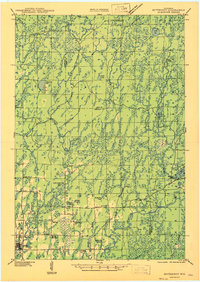
1947 Map of Butternut
USGS Topo · Published 1947About this map
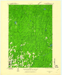
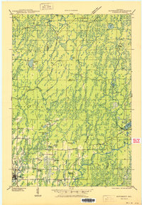
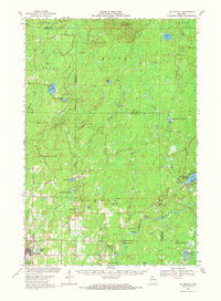
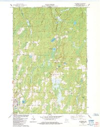
The Soo Line railroad and the Flambeau River define the local geography of this northern Wisconsin landscape as it appeared in the 1940s. The village of Butternut serves as the primary hub, surrounded by a network of rural schoolhouses such as Elmer Sch, Otto Sch, and Little White Sch that anchored the scattered farming and logging communities. Observation points like the Pleasant Lake Fire Tower and Butternut Fire Tower overlook a terrain marked by extensive glacial water bodies, including Augustine Lake, Mc Kaskel Lake, and the winding East Fork Chippewa River. The transition from old timber camps like Teeter Camp to more permanent structures like Agenda Town Hall illustrates the region's development. Local family-named water features such as Luebke Lake and Lindbergh Lake highlight the intersection of individual homesteading and the broader wilderness during this era.
Find a feature on this map
39 named features on this map. Tap any name to fly to it.
Don’t see what you’re looking for? This feature index may not catch every label — zoom into the map to look around manually.
Map Details
Editions of this 1947 Butternut Map
This is the sole edition of this map. No revisions or reprints were ever made.
Historical Maps of Mercer Through Time
6 maps found