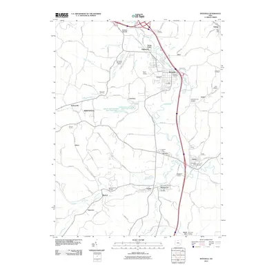
2010 Map of Byesville
USGS Topo · Published 2010About this map
Wills Creek meanders through this portion of Guernsey County, anchoring a series of small coal-era settlements including Byesville, Buffalo, and Pleasant City. The landscape reflects a legacy of community life centered on local post offices and numerous historic burial grounds, such as the Bethel Methodist Protestant Cemetery and the Saint Michael Cemetery near Robins. The drainage patterns of the Buffalo Fork and Buffalo Creek define the southern terrain, while the Indian Lakes Recreation Area Upper Lake provides a modern recreational focus near Lucasburg. This 2010 survey highlights the enduring proximity of local infrastructure, from the Cambridge Municipal Airport to the rural intersections at Opperman and Bluebell, preserving the spatial relationship between early church sites and the evolving residential footprint of the valley.
Find a feature on this map
108 named features on this map. Tap any name to fly to it.
Don’t see what you’re looking for? This feature index may not catch every label — zoom into the map to look around manually.
Map Details
Editions of this 2010 Byesville Map
This is the sole edition of this map. No revisions or reprints were ever made.
Other maps of this area

1909 · Antrim
USGS Topo · 1:48,000

1909 · Summerfield
USGS Topo · 1:62,500

1909 · Cambridge
USGS Topo · 1:62,500

1911 · Antrim
USGS Topo · 1:62,500

1911 · Cumberland
USGS Topo · 1:62,500

1911 · Summerfield
USGS Topo · 1:62,500

1912 · Cambridge
USGS Topo · 1:62,500

1949 · Clarksburg
USGS Topo · 1:250,000

1951 · Canton
USGS Topo · 1:250,000

1953 · Canton
USGS Topo · 1:250,000