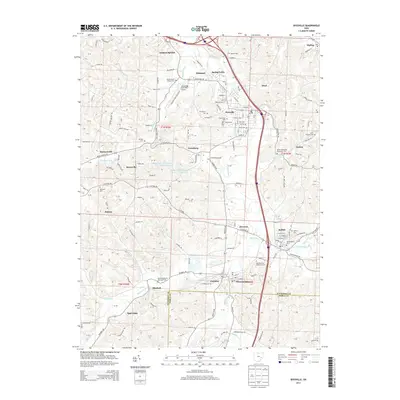
2013 Map of Byesville
USGS Topo · Published 2013About this map
Wills Creek and its tributaries define the landscape south of Cambridge, where a dense network of smaller settlements like Byesville, Buffalo, and Pleasant City cluster along the valley floor. This 2013 survey illustrates the area's transition from an industrial and agricultural past to its contemporary role as a regional hub, anchored by the Cambridge Municipal Airport. The map is particularly rich in genealogical data, preserving the locations of numerous historic burial grounds including Greenwood Cem, Saint Michael Cem, and the Old Hartford Cem near the fork of Soggy Run.
Find a feature on this map
148 named features on this map. Tap any name to fly to it.
Don’t see what you’re looking for? This feature index may not catch every label — zoom into the map to look around manually.
Map Details
Editions of this 2013 Byesville Map
This is the sole edition of this map. No revisions or reprints were ever made.
Other maps of this area

1909 · Antrim
USGS Topo · 1:48,000

1909 · Summerfield
USGS Topo · 1:62,500

1909 · Cambridge
USGS Topo · 1:62,500

1911 · Antrim
USGS Topo · 1:62,500

1911 · Cumberland
USGS Topo · 1:62,500

1911 · Summerfield
USGS Topo · 1:62,500

1912 · Cambridge
USGS Topo · 1:62,500

1949 · Clarksburg
USGS Topo · 1:250,000

1951 · Canton
USGS Topo · 1:250,000

1953 · Canton
USGS Topo · 1:250,000