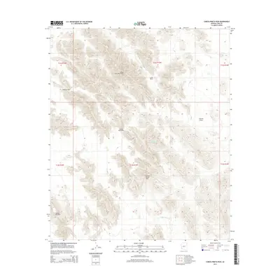
2014 Map of Cabeza Prieta Peak
USGS Topo · Published 2014About this map
Cabeza Prieta Peak rises as the central landmark of this Yuma County desert landscape, where the Cabeza Prieta Mountains dominate the horizon. Water sources, vital for survival in this arid environment, are mapped at Halfway Tank and the Cabeza Prieta Tanks, indicating the critical nature of these catchments for those navigating the region. The map details the complex terrain of the A-one Basin and the narrow passage of Cabeza Prieta Pass, reflecting the traditional routes through this isolated portion of Arizona. To the south, Tordillo Mountain and the drainage of Smoke Tree Wash define the local topography, while Surprise Canyon marks the eastern reaches of the survey. The absence of modern infrastructure highlights the preserved, wild character of the land as recorded in the early 21st century.
Find a feature on this map
15 named features on this map. Tap any name to fly to it.
Don’t see what you’re looking for? This feature index may not catch every label — zoom into the map to look around manually.
Map Details
Editions of this 2014 Cabeza Prieta Peak Map
This is the sole edition of this map. No revisions or reprints were ever made.
Other maps of this area

1953 · Ajo
USGS Topo · 1:250,000

1957 · Ajo
USGS Topo · 1:250,000

1958 · Ajo
USGS Topo · 1:250,000

1962 · Ajo
USGS Topo · 1:250,000

1963 · Ajo
USGS Topo · 1:250,000

1965 · Cabeza Prieta Peak
USGS Topo · 1:62,500
1965 · Tule Mountains
USGS Topo · 1:62,500

1965 · Isla Pinta
USGS Topo · 1:62,500

1965 · Sierra Arida
USGS Topo · 1:62,500

1967 · Ajo
USGS Topo · 1:250,000