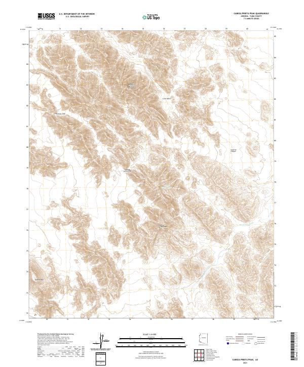
2021 Map of Cabeza Prieta Peak
USGS Topo · Published 2021About this map
Cabeza Prieta Peak rises as a central landmark within this portion of the Cabeza Prieta Mountains in Yuma County. The arid landscape is defined by its seasonal hydrology and geological depressions, notably the A-one Basin and the winding Smoke Tree Wash. High-elevation crossings like Cabeza Prieta Pass connect the steep drainages of Surprise Canyon with the surrounding desert floor. Man-made and natural water collection points, including Halfway Tank and the Cabeza Prieta Tanks, provide crucial water sources in an otherwise parched environment. The map also identifies Tordillo Mtn to the southwest, illustrating the complex topographic relief of this protected wilderness area. This modern survey illustrates the precise land management boundaries and enduring landmarks of a region largely unchanged by development.
Find a feature on this map
15 named features on this map. Tap any name to fly to it.
Don’t see what you’re looking for? This feature index may not catch every label — zoom into the map to look around manually.
Map Details
Editions of this 2021 Cabeza Prieta Peak Map
This is the sole edition of this map. No revisions or reprints were ever made.
Other maps of this area

1953 · Ajo
USGS Topo · 1:250,000

1957 · Ajo
USGS Topo · 1:250,000

1958 · Ajo
USGS Topo · 1:250,000

1962 · Ajo
USGS Topo · 1:250,000

1963 · Ajo
USGS Topo · 1:250,000

1965 · Cabeza Prieta Peak
USGS Topo · 1:62,500
1965 · Tule Mountains
USGS Topo · 1:62,500

1965 · Isla Pinta
USGS Topo · 1:62,500

1965 · Sierra Arida
USGS Topo · 1:62,500

1967 · Ajo
USGS Topo · 1:250,000