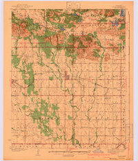
1942 Map of Cache
USGS Topo · Published 1942About this map
The Wichita Mountains Wild Life Refuge dominates the northern half of this landscape, where prominent peaks like Mt Scott and Elk Mtn rise above a complex network of man-made and natural water bodies, including Lake Thomas and Lake Jed Johnson. This area reflects the era's conservation and recreational development, featuring several CCC Camp locations and the Craterville Park grounds. To the south, the terrain transitions into an organized grid of township sections centered around the town of Cache.
Find a feature on this map
72 named features on this map. Tap any name to fly to it.
Don’t see what you’re looking for? This feature index may not catch every label — zoom into the map to look around manually.
Map Details
Editions of this 1942 Cache Map
3 editions found
Other maps of this area

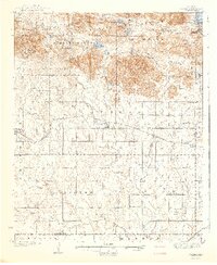
1937 · Cache
USGS Topo · 1:48,000

1937 · Quanah Mountain
USGS Topo · 1:24,000

1942 · Cache
USGS Topo · 1:62,500

1946 · Lawton
USGS Topo · 1:62,500

1949 · Mount Scott
USGS Topo · 1:24,000

1949 · Cooperton
USGS Topo · 1:62,500

1949 · Quanah Mountain
USGS Topo · 1:24,000

1949 · Fort Sill
USGS Topo · 1:24,000

1950 · Snyder
USGS Topo · 1:62,500

1950 · Saddle Mountain
USGS Topo · 1:62,500