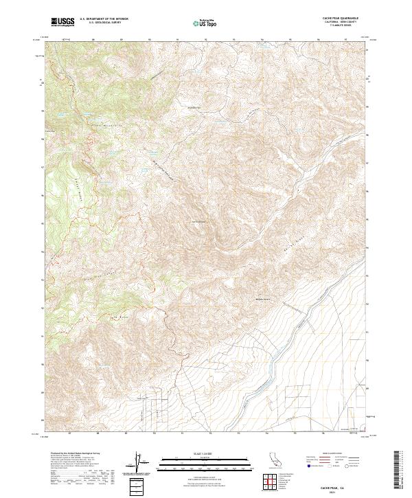
2021 Map of Cache Peak
USGS Topo · Published 2021About this map
The Piute Mountains dominate this high-desert landscape in Kern County, centered on the prominent summit of Cache Peak. The region is defined by its complex topography and critical water management systems, notably the Los Angeles Aqueduct and the Second Los Angeles Aqueduct cutting through the southeastern corner. A network of seasonal and perennial springs, such as Peeping Tom Spring, Ruth Camp Spring, and Golden Oaks Spring, provide vital water sources in this arid environment. The map captures the path of the Pacific Crest National Scenic Trl as it winds along Sweet Ridge, offering a view into the rugged transit routes through the Sierra Nevada and into the Mojave Desert. Local ranching or forestry history is suggested by the presence of Weldon Pond and several named flats and canyons, including Airplane Flat and Pine Tree Canyon.
Find a feature on this map
38 named features on this map. Tap any name to fly to it.
Don’t see what you’re looking for? This feature index may not catch every label — zoom into the map to look around manually.
Map Details
Editions of this 2021 Cache Peak Map
This is the sole edition of this map. No revisions or reprints were ever made.
Other maps of this area

1915 · Mojave
USGS Topo · 1:125,000

1943 · Tehachapi
USGS Topo · 1:62,500

1943 · Cross Mountain
USGS Topo · 1:62,500

1943 · Emerald Mtn
USGS Topo · 1:62,500

1943 · Mojave
USGS Topo · 1:62,500

1947 · Plano
USGS Topo · 1:24,000

1947 · Mojave
USGS Topo · 1:24,000

1948 · Bakersfield
USGS Topo · 1:250,000

1955 · Bakersfield
USGS Topo · 1:250,000

1956 · Bakersfield
USGS Topo · 1:250,000