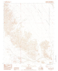
1984 Map of Cadiz Valley NW
USGS Topo · Published 1985About this map
Cadiz Valley dominates this 1984 provisional survey, revealing the stark topography of the Mojave Desert floor as it meets the edge of Cadiz Lake. The map illustrates a landscape defined by dramatic elevation changes, with the dry lake bed in the northeast corner serving as a low-point basin for the surrounding terrain. Sparse human intervention is marked only by remote 4wd tracks that navigate the alluvial fans and complex contouring of the region. This document captures the wilderness in a transitional state during the mid-1980s, providing a precise record of desert geomorphology before modern digital mapping. The use of metric contours on this provisional edition reflects a specific era of USGS cartographic standards, emphasizing the physical geometry of the valley and the salt crust margins of the lake.
Find a feature on this map
3 named features on this map. Tap any name to fly to it.
Don’t see what you’re looking for? This feature index may not catch every label — zoom into the map to look around manually.
Map Details
Editions of this 1984 Cadiz Valley NW Map
2 editions found
Other maps of this area

1942 · Amboy
USGS Topo · 1:250,000

1943 · Amboy
USGS Topo · 1:250,000

1943 · Cadiz Lake
USGS Topo · 1:62,500

1943 · Cadiz Valley
USGS Topo · 1:62,500

1954 · Needles
USGS Topo · 1:250,000

1956 · Needles
USGS Topo · 1:250,000

1956 · Dale Lake
USGS Topo · 1:62,500

1956 · Bristol Lake
USGS Topo · 1:62,500

1956 · Cadiz Lake
USGS Topo · 1:62,500
1956 · Cadiz Valley
USGS Topo · 1:62,500